More changes are on the way for the bi-state ahead of our next push of cool, fall air over the weekend.
Strong south winds bring in warm temperatures today, with highs topping out in the 70s. Most of today is dry, with light morning showers exiting before the lunch our.
Sunshine warms us through the afternoon, with wind gusts up to 30 mph ahead of a cold front that will sweep in overnight into Sunday.
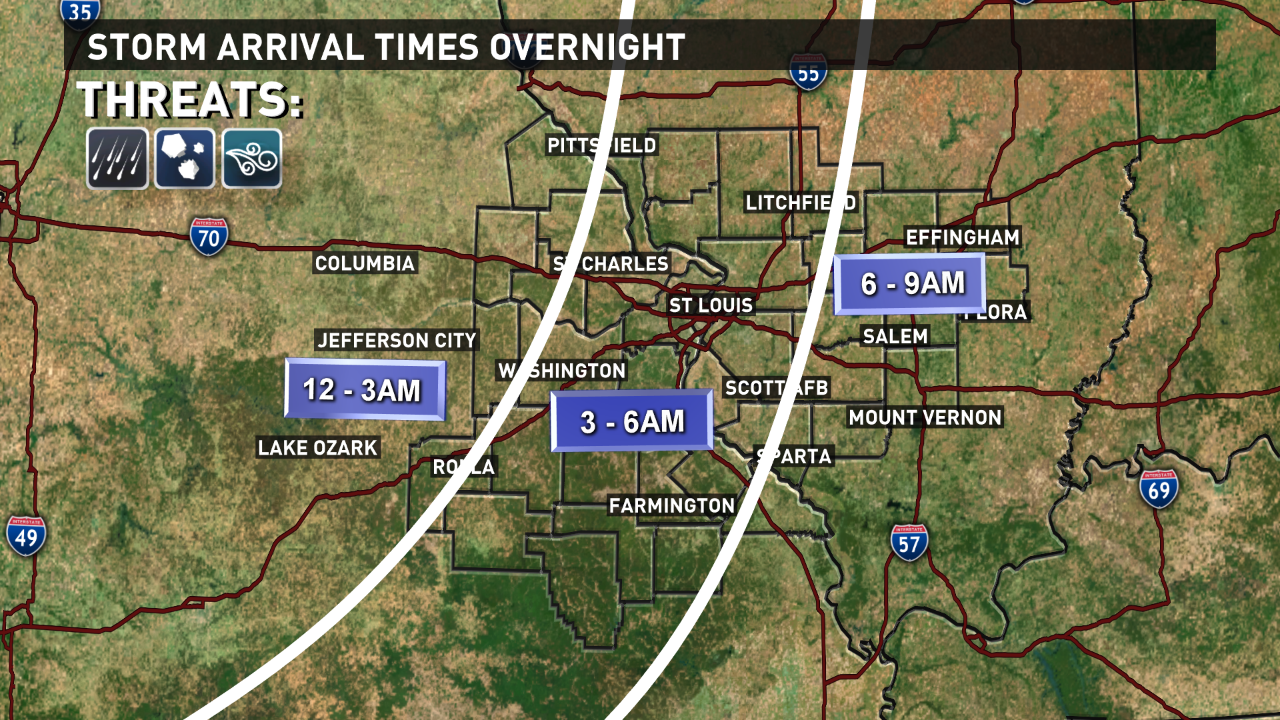
Showers and storms are expected to develop as a line along the cold front late tonight, pushing into our western counties sometime after 2AM, and arriving into the St. Louis metro between 3-5AM.
Most areas east of the Mississippi River stay dry until about 5-6AM, with lingering scattered showers throughout the day Sunday.
A secondary wave of showers is possible Sunday night, but most areas around and west of St. Louis will be dry for the Monday morning commute to work and school.
The severe weather risk is low overnight for most of the area, but we'll closely monitor the leading edge of the line of storms as it approaches the western edge of our viewing area late tonight for the potential of gusty winds and small hail.
The severe threat will diminish as storms approach St. Louis before dawn. Temperatures don't rise much during the day Sunday; topping out into the mid-upper 60s.
Between 1/2" to 1" of rain is expected across the bi-state through Monday morning, with slightly higher amounts in places that experience stronger thunderstorms.
Drier and cooler air settles in by Tuesday into Wednesday with our next front.
Stay with the 5 On Your Side Weather team for the latest adjustments and updates to the weekend forecast.