
A warm front lifted north across the bi-state Saturday, pulling in in much warmer than average air to the region.
A powerful storm system to our west is bringing blizzard-like conditions to Colorado, Nebraska, and into Iowa today, and will impact the St. Louis area overnight.
Since we are in the warm sector of this disturbance, we won't see any wintry weather overnight. Showers and thunderstorms are expected to develop out ahead of a cold front late tonight, tracking across central Missouri before midnight.
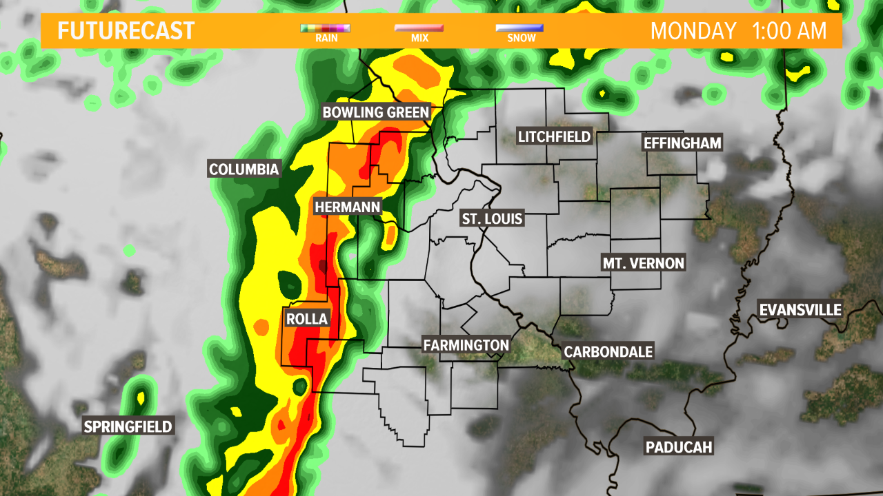
A line of thunderstorms with heavy rain will arrive west of St. Louis after midnight. We will closely monitor our western and southwestern counties for the possibility of gusty or damaging winds as the line gets organized. Overall, the severe weather threat is low, but still should be mentioned since severe weather isn't as common for the bi-state in January.
Storms will arrive in the St. Louis metro area sometime after 4 a.m. and should exit east before the heaviest part of the morning rush. Storms will still impact Illinois communities in the 5 On Your Side viewing area through late morning.
Rainfall between 0.5" and 1" is possible, with the higher amounts in stronger thunderstorms.
Monday will be very windy, with gusts in excess of 30 mph possible. Temperatures will fall from the upper 50s to low 40s by the end of the day, with overnight lows into Tuesday morning in the low 30s.
Some flurries or light rain showers are possible late Monday night as low pressure is slow to exit north and east.
Stay with 5 On Your Side Weather and tune into Today in St. Louis Monday morning at 4 a.m. for the latest on your morning commute.