
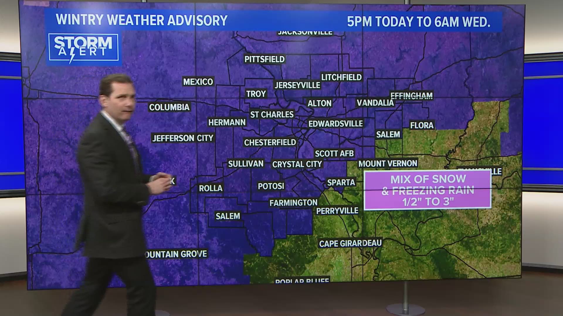
A winter weather advisory is in effect for the bi-state from 5 p.m. Tuesday through 6 a.m. Wednesday for wintry precipitation. Areas of snow, freezing rain and sleet moved into the area Tuesday night.
The snow will transition to sleet or freezing rain by late evening and continue shortly after midnight.
Surface temperatures will slowly rise above freezing around 3 a.m. with a changeover to rain or drizzle before it tapers off.
This evening's snow totals will range from 1/2" to 2 or 3" depending on when it starts, and when it transitions to sleet and freezing rain.
A light glazing of ice is also possible.
As surface temperatures warm above freezing after 3am, freezing rain will transition to rain and drizzle.
Tomorrow's commute looks damp with patchy fog and drizzle lingering around sunrise.
Temperatures will warm into the mid to upper 40s Wednesday afternoon.
We will enjoy a couple of quieter days before rain chances return late Friday and Saturday. Saturday will be much warmer with highs in the upper 50s.
RELATED: Live interactive radar
5 On Your Side weather app
iPhone | Google Play