ST. LOUIS — Meteorologists around St. Louis are shaking their heads. This week's forecast is not a neatly ironed and folded stack of rain and snow. Instead, we're looking at a pile of crumpled clothes in the corner of a teenager's room: some snow, some ice, a round or two of rain and a general mix of everything wintry.
Here's what we're expecting:
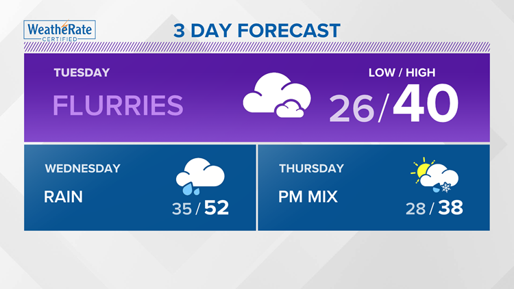
Tuesday: A few areas of flurries or sprinkles, otherwise cloudy and cold with highs in the upper 30s. Areas to the west, from Kansas City toward Columbia, MO, will start to see their first round of snow/sleet before changing to all rain Tuesday afternoon and evening. Heavier snow is expected from St. Joseph, MO toward Iowa and Wisconsin.
Wednesday: Steady rain arrives during the day. Rain will push south and east for the evening with a brief period of snow and sleet and only spotty areas of a dusting are expected. Highs will top out in the upper 40s before cooling down into the 20s overnight.
Thursday: Dry and cold to start with temperatures only climbing into the 30s, then a wintry mix of sleet and freezing rain arrive for the evening hours, with temperatures near freezing at the time the precipitation begins. .10" - 20" of ice accumulation is expected in a few places, mostly NW of the metro area.
Friday: Early morning wintry mix with temperatures near freezing, then changing to all rain through the day. Highs are expected to climb near 45.
The video below gives us a rough idea of what is arriving and when. For my savvy weather watchers, this is the latest ECMWF model run from Monday afternoon.