ST. LOUIS - After an unseasonably warm Monday, major changes are on the way for the rest of the week.
Very strong winds will persist through the afternoon and overnight hours before a strong cold front arrives this evening. Winds could gust between 30-35 mph in the afternoon.
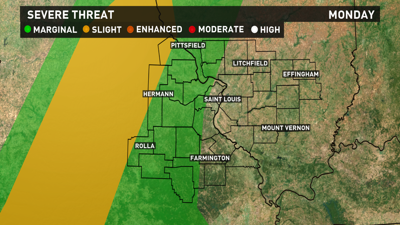
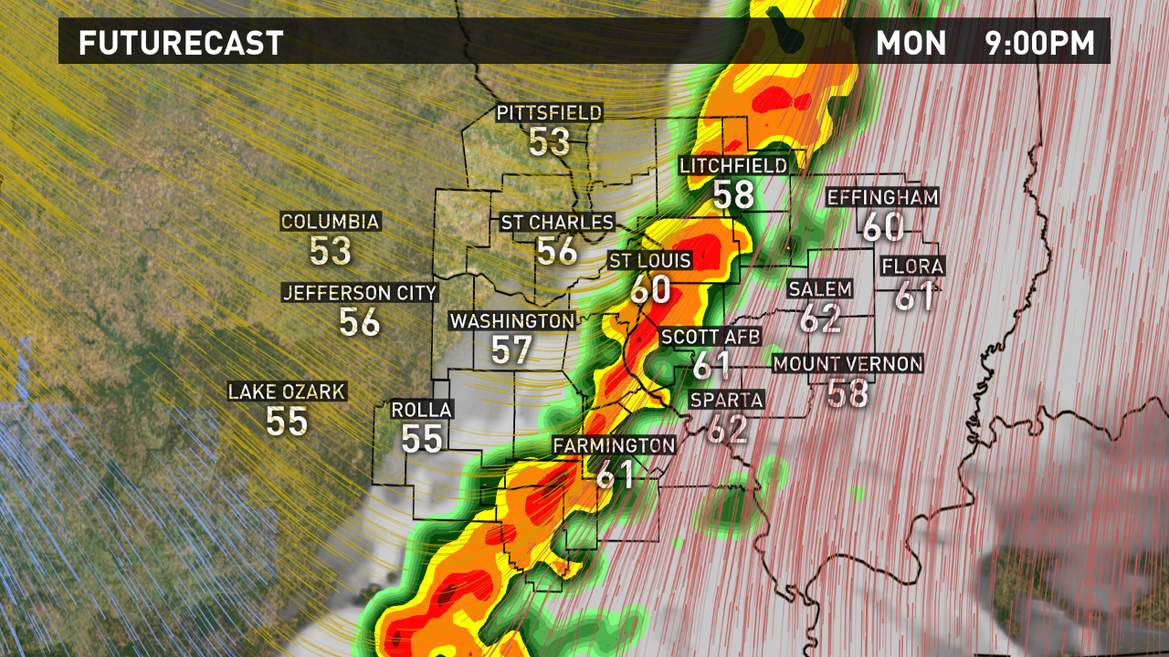
Showers and thunderstorms will develop along the front this evening, moving into areas west of St. Louis between 6-7 PM. Some of the storms could be strong to severe, especially across central Missouri. Isolated damaging winds and large hail will be possible in some of the thunderstorms.

The line of storms is expected to arrive in the St. Louis metro between 8-9 PM, then continue pushing southeast tonight. Most of the bi-state should be storm-free after midnight.
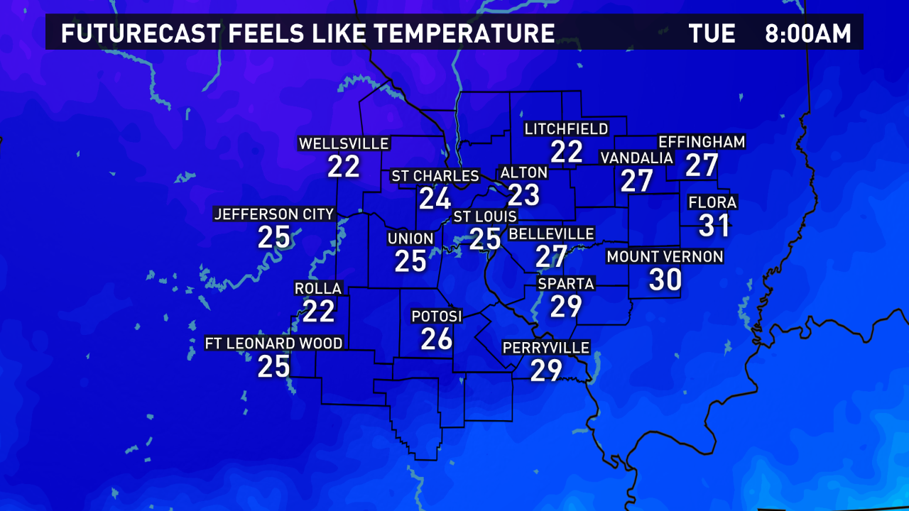
Much colder air will settle in with gusty northwest winds late tonight into Tuesday. Wind chills on Tuesday morning will hold in the mid-20s with morning temperatures in the mid-upper 30s.

The rest of the week will feature highs in the 40s on Tuesday and Wednesday, and a reinforcing shot of colder air by Thursday will keep lows in the low 20s into the weekend.
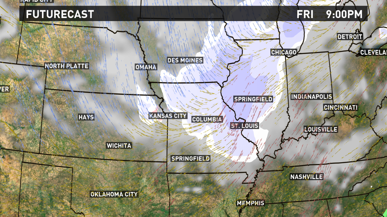
The 5 On Your Side Weather team is keeping a close eye on our next clipper system that is expected to arrive on Friday. The exact timing is still unclear, but temperatures will be cold enough for any precipitation to fall as snow showers.

Precipitation is expected to exit east by early Saturday, but stick with 5 On Your Side for the latest updates throughout the week.


