ST. LOUIS — As we near the date for last year's severe weather outbreak in our area, it's an important reminder that severe weather can happen at any point during the year.
We're heading into a bit more of an active pattern for the next few days, and that includes severe weather potential in our region.

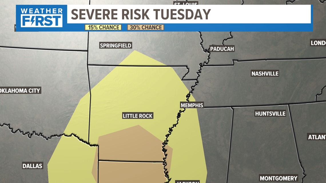
I want to point out that the Storm Prediction Center has been monitoring a severe weather threat in the region over the last few days, mainly to our south. Typically we see these outlooks for the next three days, but this is a significant enough risk that it requires advance notification.
You'll also notice this threat is much further south than anywhere in the bi-state region. That is good news for us, of course.

St. Louis severe weather threat
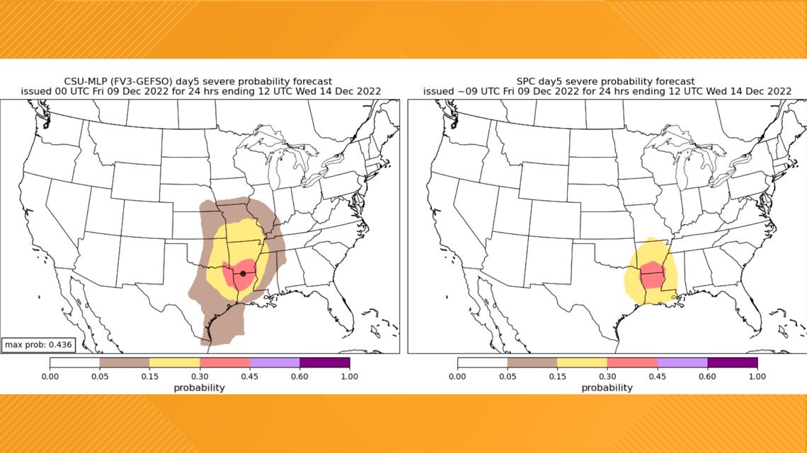
To expand upon this a little bit, we'll go into "Nerd Alert" mode here. Colorado State has a set of computer models which take into account the "machine learning probability" of severe weather chances within a certain radius. You may notice how it aligns with the Storm Prediction Center's prediction. The Colorado State forecast model is on the left in the image above and the Storm Prediction Center is on the right.
This particular CSU comparison does include our area. It basically means our chances aren't "zero" for severe weather next week. I'm going to highlight a few reasons why our severe weather chances are limited early next week, and why we're even talking about severe weather in December.

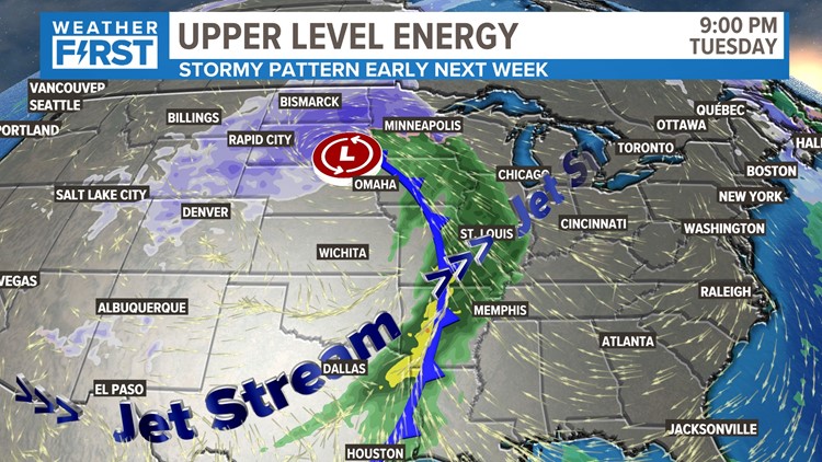
This storm is still developing off the coast of the Pacific Northwest. It will bring heavy rain and mountain snow to many areas in the west before it marches into the Plains and brings all sorts of chaos from north to south.

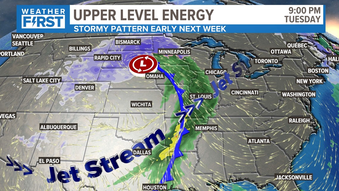
So here are a couple of reasons why we have to monitor this particular system for severe weather this time of the year. As this cold front moves in, the location of the jet stream is significant. This helps deliver strong upper-level wind that will coincide with the deep gulf moisture at the surface. While we're involved in that to some degree, the deep surface moisture and more warm, unstable air are much further south due to the timing and other ingredients during this Tuesday evening/night.

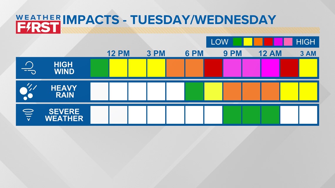
As this system approaches Tuesday night into Wednesday morning, look at the times I've highlighted above. The late nature of its arrival really takes away from our peak "heating" of the day (it is still December, after all.) The better ingredients for severe weather look to be further south at this point. We will keep you posted if this changes at any point. Our main threats look to be heavy rain and high wind gusts that aren't related to thunderstorms.

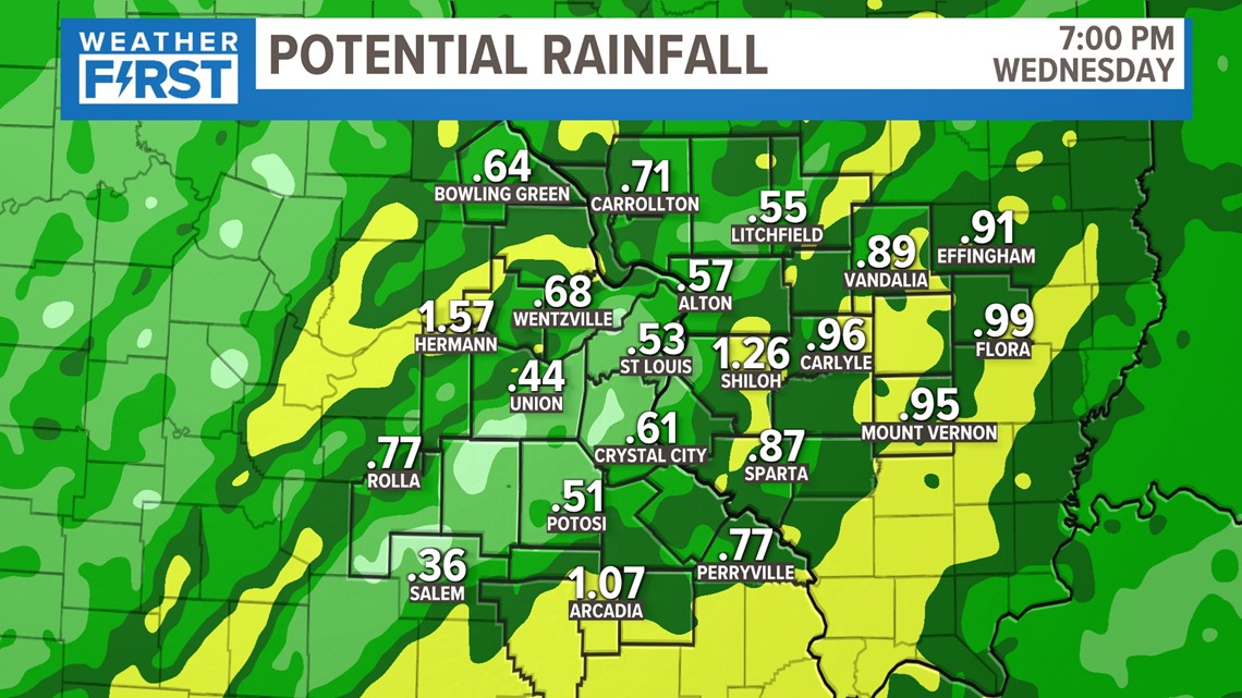
While thunderstorms are possible, they will be more responsible for localized bursts of heavy rain than anything else. We can expect upwards of 1 inch of rain during this period, with 2 inches being on the high side.
Keep in mind, this is still a few days away. Things can certainly change. Take peace of mind heading into the weekend that severe weather is not a threat in our area at this time, and we'll monitor where the threat pops up to our south.