
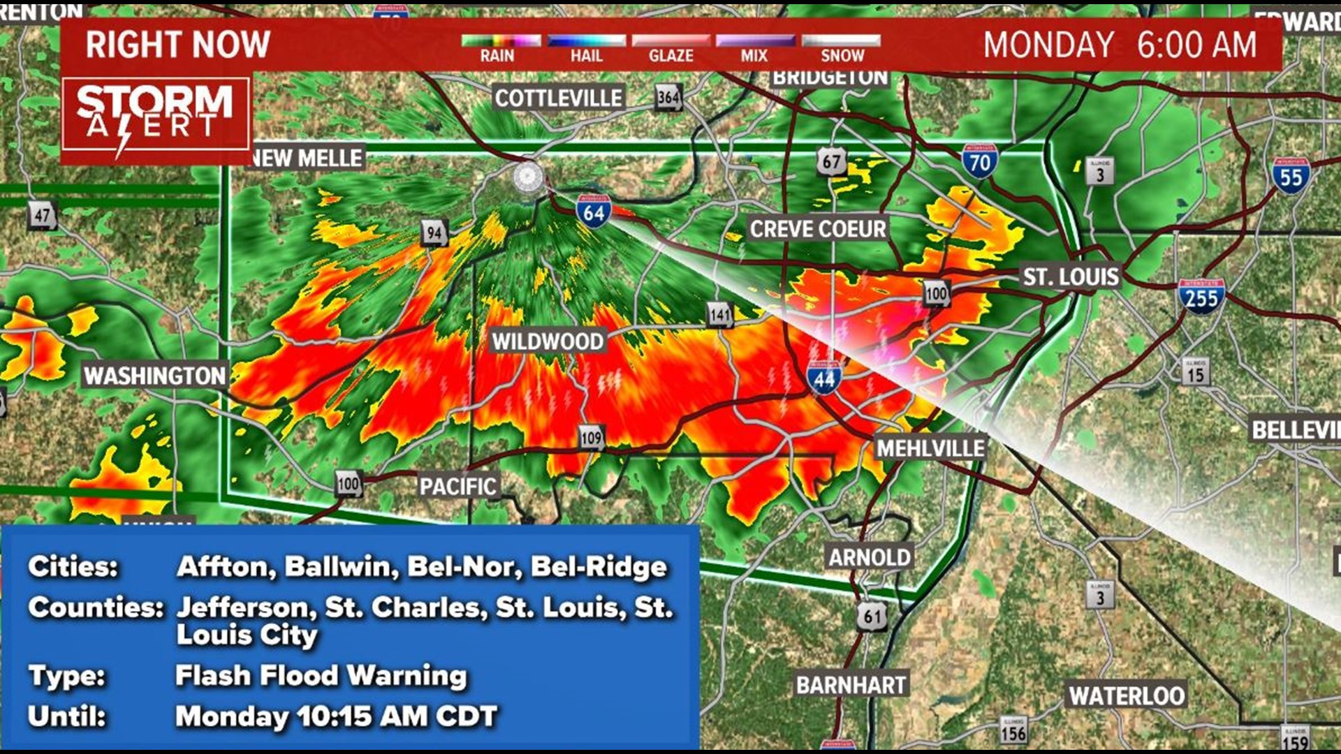
ST. LOUIS — A flash flood warning has expired for the St. Louis area.
Parts of the warning area got hit with heavy rain at the rate of 1-3 inches per hour. All of it happened during the Monday morning commute, leading to road closures and school closings in the area.
The morning rain has cleared the St. Louis area. We'll get a glimpse of sunshine in the afternoon. With the sun, expect warmer 80s for afternoon temperatures ahead of a cold front that arrives later Monday.
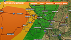
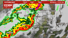
Now that the morning storms have passed, we're focusing on another round of severe weather expected Monday night.
There is a “marginal” to “slight” risk for severe thunderstorms. A few thunderstorms may produce damaging winds and isolated large hail.


RELATED: Live interactive radar
The best chance for stormy weather will arrive after 8 p.m Monday. Storms will continue overnight, then ease away by Tuesday morning.
Behind the cold front, Tuesday is a little cooler and turns bright and sunny. Expect more nice weather for the rest of the week, followed by another chance for rain this weekend.
Download the free 5 On Your Side news and weather apps by clicking the links below to get weather alerts sent straight to your cell phone or tablet.
5 On Your Side weather app
iPhone | Google Play
5 On Your Side news app
iPhone | Google Play