ST. LOUIS — Snow is moving into Missouri late this afternoon. Soon, that snowfall will make it to St. Louis. We have already had reports of snow from Weldon Spring to Sullivan, MO.
5 On Your Side is in Storm Alert.
Download the free 5 On Your Side app to get the latest watches and warnings and track conditions live with our interactive radar. Use the links below to download now.
5 On Your Side news app
iPhone | Google Play
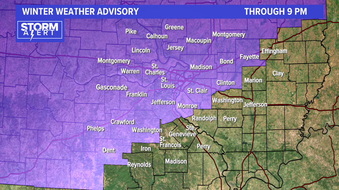
The National Weather Service has issued a Winter Weather Advisory for the counties highlighted in purple on the map below. The advisory ends at 9 P.M.

For the counties further south and east of St. Louis, the first few hours will be rain and a wintry mix. After sunset, snow will be widespread.
The video below is a guideline for the timing of rain, wintry mix and snow.
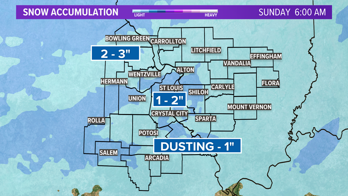
Snow totals will vary quite a bit: 1 to 2 inches is expected for St. Louis, but areas north and west could see 2 to 3" inches.
Travel along I-70 will be challenging. Bands of heavy snow will cause visibility issues Saturday night.
The Missouri Department of Transportation has had crews out for the last couple of days to treat the roads ahead of the storm.
"They're going to be ready when this storm actually hits the area and be ready and start treating as soon as it starts coming down," said Bob Becker, MoDOT's St. Louis district maintenance engineer. "The biggest concern right now is getting in there and getting the treatment down and trying to get as much out there as we can before the temperatures really drop overnight.

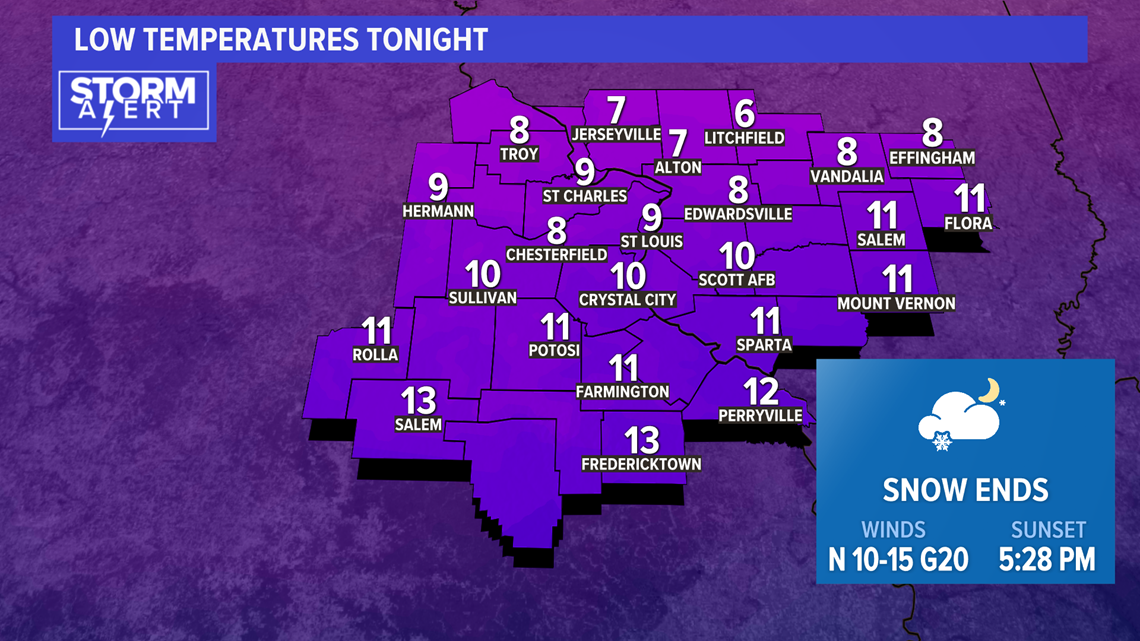
Really cold air arrives overnight. With the snow on the ground, overnight lows will dip into the single digits. It will also be breezy with a North wind 10-15 miles per hour, so expect wind-chill temperatures below 0.

The cold weather is expected to linger through most of next week. Late Sunday night into Monday, another fast-moving system will drop in from the northwest. These clipper type systems are starved for moisture but have a tendency to squeeze out all of the moisture they can. This could result in accumulating snow early in the week.
The brunt of the arctic air will then hang around the area for most of next week. If there is some snow on the ground, and we believe there will be, some of us may have subzero low temperatures. In order for that to happen, the winds will have to die down and skies clear toward the middle of next week. Stay tuned.