

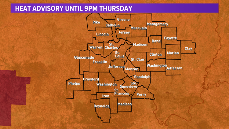
ST. LOUIS — Dangerously hot weather is here through Thursday. A heat advisory lasts until 9 p.m.
The end of July in St. Louis typically means two things: heat and humidity and this year is no different.
High temperatures will soar into the mid- to upper-90s Thursday afternoon and early evening. Humidity levels are expected to remain uncomfortable ahead of a cold front that will be dropping south from the upper Midwest.
Heat index values are expected to climb to around 100-110 degrees or more Thursday afternoon and early evening.


Remember, hot temperatures and high humidity may cause heat-related illnesses. Drink plenty of fluids, get in the air-conditioning occasionally, stay out of the sun and check up on friends, relatives and neighbors. Make sure your pets have cool and fresh water to drink, but bringing them indoors is always the best option during extreme heat.
Heat advisories, excessive heat watches and excessive heat warnings extend from the Gulf of Mexico up into our area as another large high pressure dome causes air to sink and heat up over a very large portion of the United States.
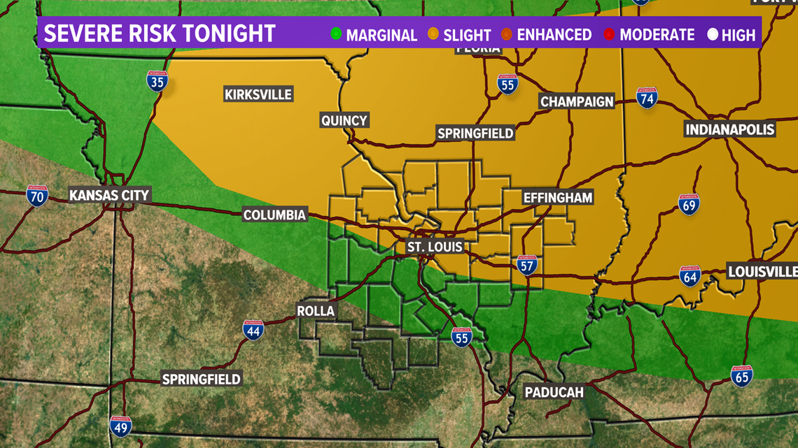
A cold front will be moving through the area Thursday evening and will be well to the south of the metro Friday morning. The storm prediction center has placed most of the area in a marginal risk and slight risk for severe thunderstorms Thursday evening on into the overnight. A slight risk is marked in the yellow area of the map below. A marginal risk, marked in green on the map, is a low level 1 risk out of 5. A slight risk is level 2 out of 5.

Then, a better chance and more likely chance of thunderstorms will be late Friday night into early Saturday. Temperatures will also drop back into the upper 80s on Friday and lower 80s Saturday and Sunday. Also, much less humid air arrives as the rain exits Saturday into early Sunday and stays comfortable into all of next week.
Friday will be cooler in the mid- to upper-80s with scattered thunderstorms. Also, rain and thunderstorms are likely Saturday morning into the early afternoon with mostly cloudy skies. Highs will only be in the low 80s.
We are forecasting cooler and much less humid air behind the front as we head into Sunday and all of next week with highs in the 80s. So, August will have a nice comfortable start with below average temperatures and comfortable humidity levels.
Download the free 5 On Your Side app to get the latest watches and warnings and track conditions live with our interactive radar. Use the links below to download now.
5 On Your Side news app
iPhone | Google Play
