
ST. LOUIS — After highs in the 70s on Sunday and Monday, St. Louisans are in for an adjustment as colder air returns to the area Tuesday.
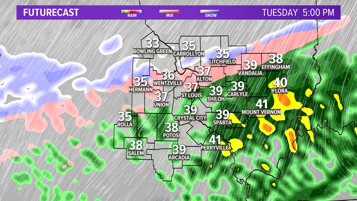
Tuesday is all about rain - most of it arrives in the St. Louis area toward late morning and lunchtime. It'll be light showers during the day, but toward dinner and bedtime there will be snow and sleet that mix in with rain.
As the cold air gets entrenched across the area later Tuesday afternoon and Tuesday evening, a bit of a wintry mix may develop. Given the warmer ground temperatures, it is unlikely to have much of an impact on travel other than wet roads.
Download the 5 On Your Side app to track the wintry weather with radar and get the latest updates for your area:
5 On Your Side weather app
iPhone | Google Play
5 On Your Side news app
iPhone | Google Play

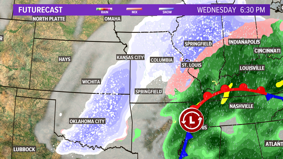
Another surge of moisture moves across the bi-state region Wednesday into Wednesday night. Much of this will fall as snow with a bit of a wintry mix expected farther south and southeast of St. Louis. The most intense time for the storm is likely during the evening hours Wednesday creating sloppy travel conditions.
RELATED: Live interactive radar

Snow totals by Thursday could amount to 3 to 6 inches in St. Louis metro, and perhaps locally more than 6 inches west of St. Louis county. East of St. Louis, snow totals will range from 1 - 3 inches.

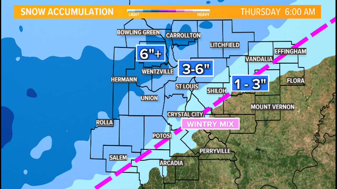
The snow should diminish to flurries by early Thursday morning. Temperatures will stay in the 30s for highs for the end of the week with a fresh snow pack.