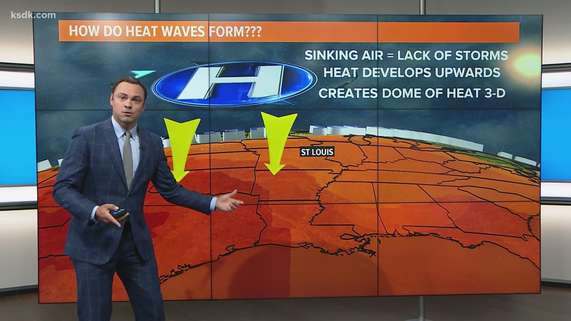
ST. LOUIS — High humidity has returned to St. Louis ahead of an approaching cold front Wednesday. A few brief, showers are possible during the morning hours, but the better chance of stronger thunderstorms appears to be during the afternoon and evening.
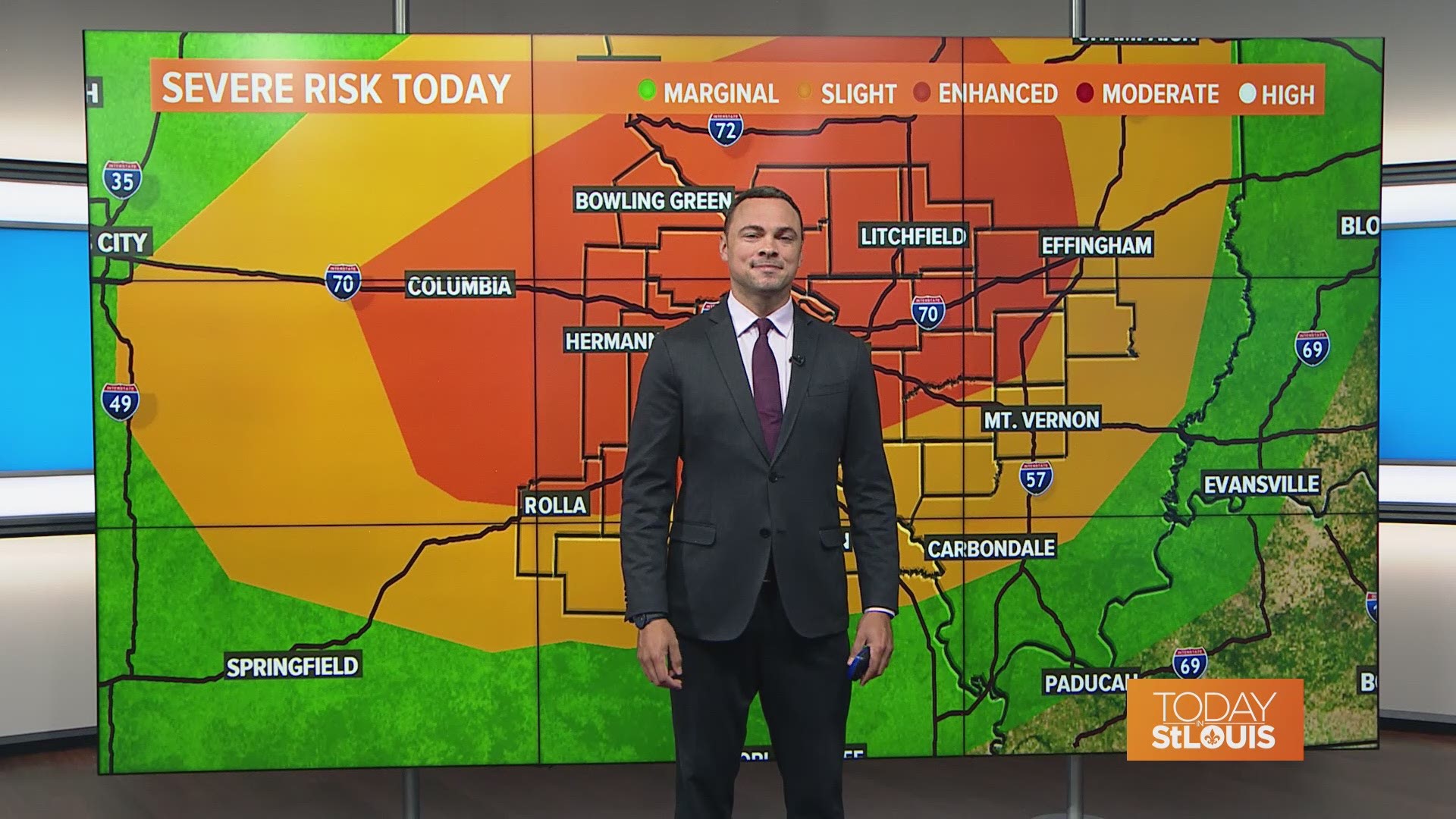
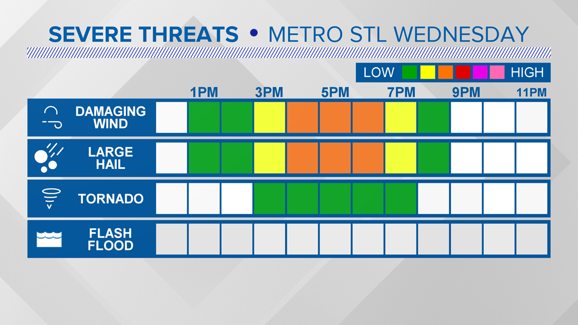
Some of the storms are expected to produce tornadoes, gusty winds and hail. Afternoon temperatures are expected to climb into the upper 80s and lower 90s before the storms arrive with heat index values approaching 100 degrees.

Download the free 5 On Your Side app to get the latest watches and warnings and track conditions live with our interactive radar. Use the links below to download now.
5 On Your Side news app
iPhone | Google Play
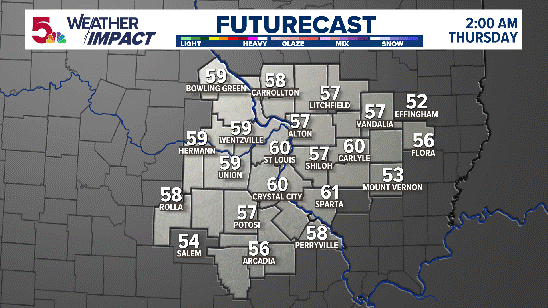
By early Thursday morning, the rain chances will diminish. There is a low chance of a spot shower or storm Thursday and a slightly higher chance some of us will see a storm on Friday as we transition into our hot weekend weather pattern.
The main severe weather threat is gusty winds and hail. There is a low chance of an isolated tornado as well.
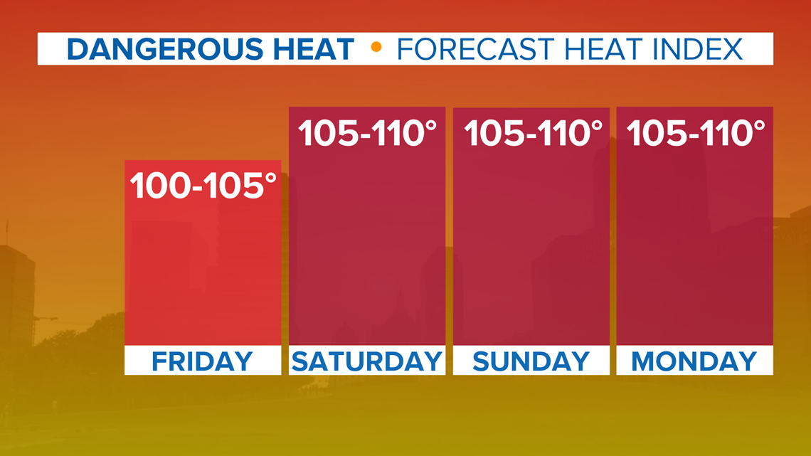
Dangerous heat will build into the area Friday into the weekend. Weekend heat index values will range from 100 to 110 degrees.

Prolonged exposure to the heat and humidity levels we expect to see this weekend can lead to heat exhaustion or heat stroke.

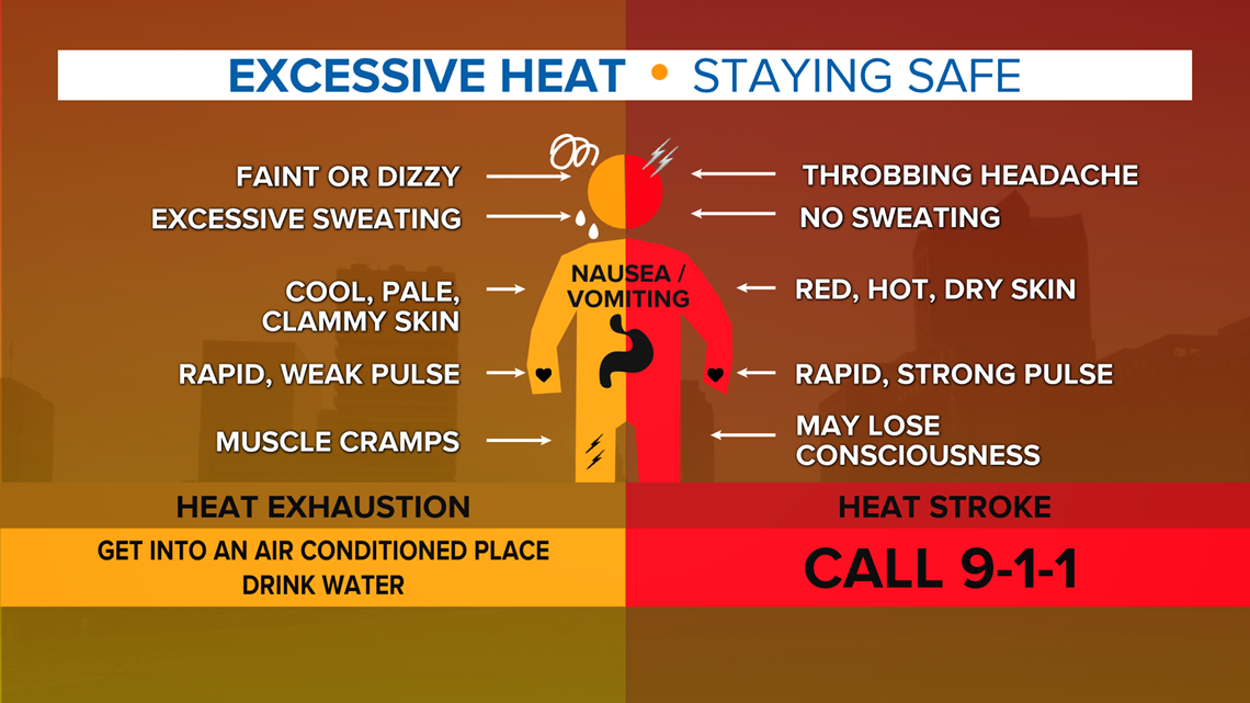
Plan to reduce any strenuous activity this weekend and stay hydrated. Use sunscreen liberally.