

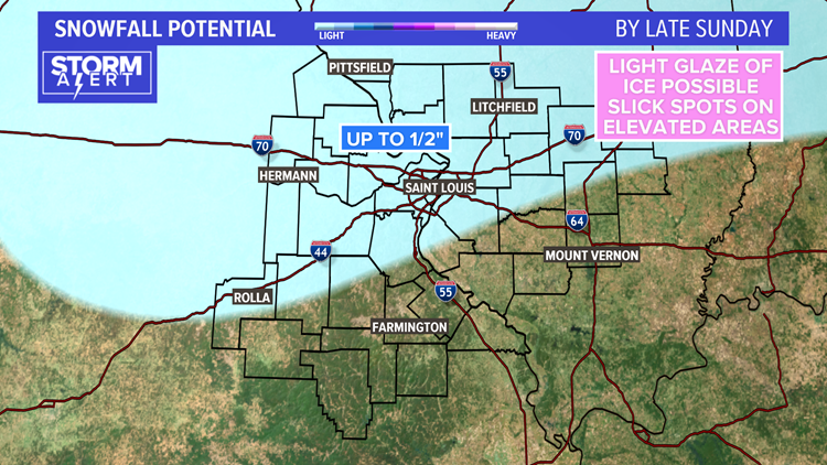
ST. LOUIS — This dynamic system is slow to move out of our region. As of Sunday morning, St. Louis Lambert International Airport has recorded 11.0" of snow. A few areas have around or a little more than a foot of snow. Additional accumulation today will be less than 1/2".
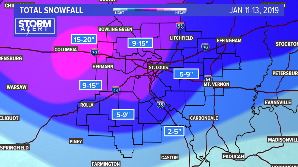
The highest snow total has been in Montgomery County, Missouri where an observer in Montgomery City reported 20.0 inches of snow!
A few light snow showers are possible through early Sunday evening, with some freezing drizzle mixed in for the metro and points south.
RELATED: Watch Live Radar
A deep blanket of snow covers the region with the area of heaviest snow centered in parts of mid Missouri. Locally 15 to 20 inches of snow in this area. Most of the metro area received nine to eleven inches of fresh snow.

Get Our Weather App!
Roads are mostly wet, but there could be some re-freeze issues this evening on untreated surfaces, or elevated roadways like ramps or bridges. Watch for icy patches and plan for a slower Monday morning commute.
RELATED: Latest 5 On Your Side forecast
Most areas have seen the biggest snow totals since January 2014.
