
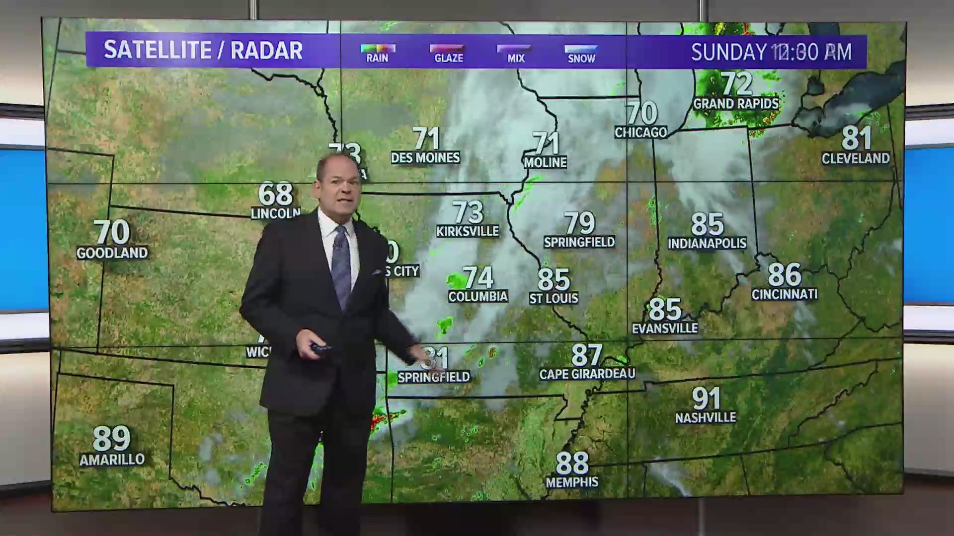
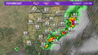
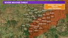
ST. LOUIS — Strong thunderstorms have developed over parts of southwest Illinois and the eastern Ozarks of Missouri early Sunday afternoon. Dangerous lightning, gusty winds and heavy rain are the main threats with these storms.
RELATED: Live interactive radar
The storms are moving to the east-northeast and will be moving through areas east and south of St. Louis through the afternoon. Most likely, the storms will be out of our area by early Sunday evening.

Some of the storms will be moving over popular Missouri float streams and Rend Lake. Those enjoying the outdoors may need to find safe shelter until the storm threat ends. Lightning can often jump ahead of the main thunderstorm.
A severe thunderstorm watch has been issued by the Storm Prediction Center for areas east and south of St. Louis until 7 p.m.

Seasonably warm and humid conditions are expected away from the storms with temperatures in the 80s to around 90 and heat indices in the mid-90s to near 100 in areas where the sun breaks through the clouds.
Downloading the 5 On Your Side app allows you to track thunderstorms and get notifications when the National Weather Service issues watches and warning for your area.
5 On Your Side weather app
iPhone | Google Play
5 On Your Side news app
iPhone | Google Play
Additional thunderstorms are possible again Monday and Wednesday with only a a slight chance of storms on Tuesday. Tuesday should be the hottest day of the week with highs in the low to mid-90s and head indices at or above 100°.
Cooler weather will arrive toward the end of the week providing a break from the typical August heat and humidity.