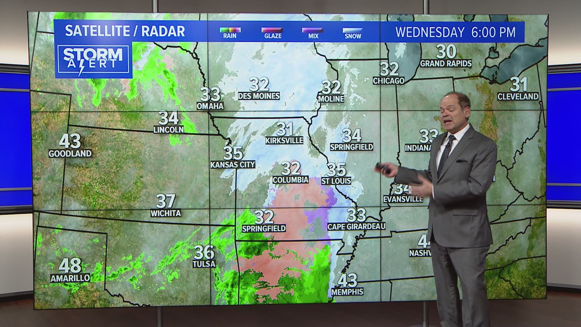
ST. LOUIS — A wintry mix of sleet, snow and rain, even some freezing rain has moved into the bi-state region Wednesday evening. A winter weather advisory remains in effect through noon Thursday for much of the area.
The first round has created a few reports of slick spots with rural roads and elevated surfaces more likely to be a bit icy.
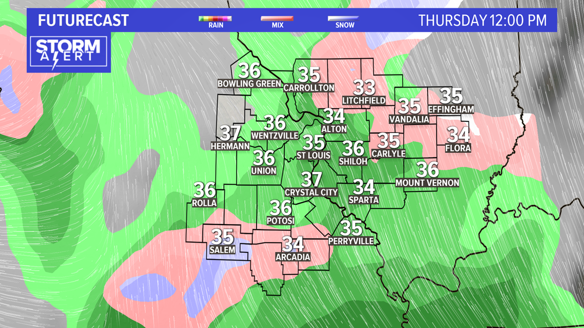
Thursday morning, temperatures will be close to freezing during the early morning rush hour with a light wintry mix continuing. Untreated surfaces will likely be icy. Total ice and snow accumulation is likely to be fairly low with less than an inch expected.

RELATED: Live interactive radar
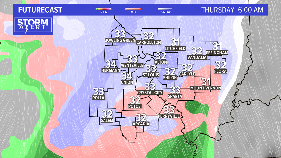
During the morning, the wintry mix is likely to change to mostly rain through the middle of the day before changing back to mostly snow by later Thursday.

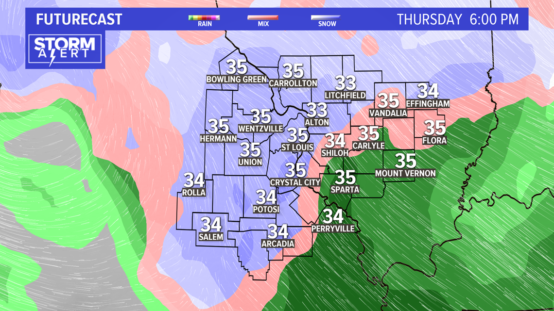
The snow north and west of St. Louis could be a bit more intense Thursday evening. Fat wet snowflakes will likely fall as temperatures again hover close to freezing.

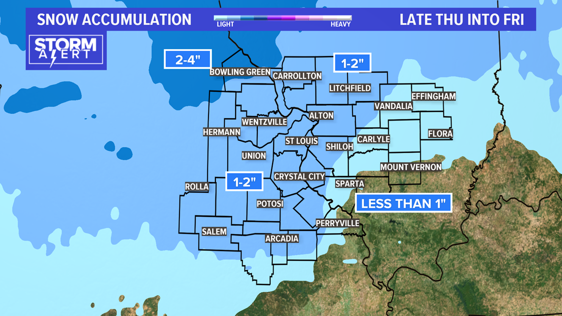
The heaviest snowfall with this round is expected to be over parts of mid-Missouri into northeast Missouri where two to four inches of snow may accumulate. In the metro St. Louis area, one to two inches of snow accumulation seems probable. Snowfall amounts will get lower farther east and southeast of St. Louis where slightly warmer air is expected to be drawn into this weather system.

Download the 5 On Your Side app to track the wintry weather with radar and get the latest updates for your area
5 On Your Side news app
iPhone | Google Play
On Friday into Friday night, the snow or mixed precipitation will become more showery in nature with limited potential of any additional accumulation. Daytime temperatures remain in the mid to perhaps upper 30s and the overnight lows drop to around freezing again by Saturday morning.
During the day Saturday, the system moves away, but it will stay cloudy and chilly. Sunday is expected to be mostly cloudy with temperatures close to 40° for the high.