
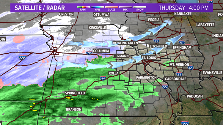
ST. LOUIS — Light snow is flying around Kansas City this Thursday afternoon. Our well advertised storm system is coming together according to plan. We will eventually see showers developing this during the early evening with a transition to mixed precipitation and snow by late evening into early Friday.
Ground temperatures around St. Louis are in the 40s, so a lot of the mix and snow that falls tonight will melt on contact with the ground. Overnight lows will be in the lower to mid 30s across the region. Grassy and elevated surfaces, especially north and west of St. Louis may have some minor accumulations, generally ranging from a dusting to an inch. A few spots in our northern and westernmost areas could see a bit more. North of the 5 On Your Side viewing area, over northeast Missouri 1-2 inches is possible.
The overnight snow showers should be gone before sunrise, but it looks like we will have another chance of snow showers Friday afternoon and evening as some more energy wraps around the back side of the exiting system.
We will have a hard freeze Friday night as skies clear and lows drop into the lower 20s. Saturday will be mostly sunny but cold with highs in the mid to upper 30s.
Each hour we are getting updated model information that we will be analyzing and sharing with our viewers on air during our evening newscasts.
You can follow me on instagram and twitter @craigksdk, and on Facebook at "Craig Moeller KSDK". I will be frequently updating our social media accounts and KSDK.com!
