


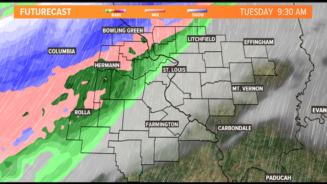
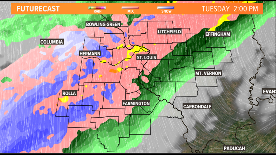
ST. LOUIS — Tuesday morning will start off cloudy with temperatures in the upper 30s and lower 40s. Toward the end of the morning hours, rain and snow will spread across the Bi-State. The rain/snow mix will eventually transition to all snow into the afternoon and evening as colder air moves in.
Download the free 5 On Your Side app to get the latest watches and warnings and track conditions live with our interactive radar. Use the links below to download now.
5 On Your Side news app
iPhone | Google Play


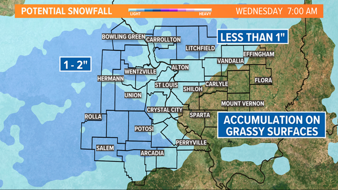
Snowfall totals will remain confined to grassy or elevated surfaces with upwards of 1 inch or less for St. Louis. Locations north and west of the metro area, could see upwards of 2 inches of grassy accumulation.

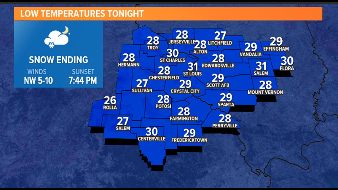
Temperatures also will turn colder through the day with 40s by late morning and 30s by the afternoon. In fact, temperatures take a tumble overnight with most locations falling back into the upper 20s for lows.
Tender plants that cannot tolerate sub-freezing temperatures will need protection from the cold. If you have already hooked up your water hose, you will want to unhook it by Tuesday evening and drain it to prevent the hose from freezing and bursting.

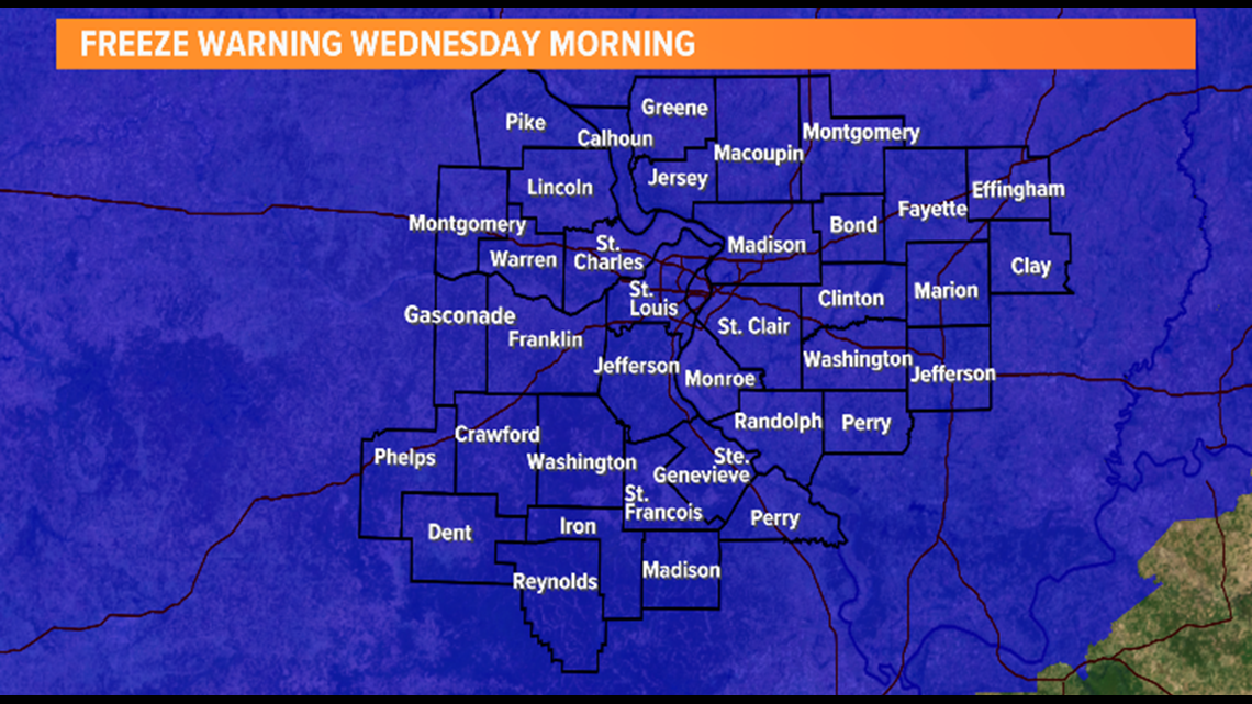
Wednesday morning will start off with freeze warnings and a decent rebound in afternoon temperatures. There will be another round of freezing temperatures for Thursday, so isolated frost and freeze are possible then as well.

By the weekend, temperatures will start to improve with the return of 60-degree weather.
