

ST. LOUIS — The frigid weather pattern continues throughout the weekend across the bi-state. With snow on the ground, overnight lows by early Sunday morning will be at or below zero in many areas.
In addition, a stiff wind will continue creating dangerously cold feels-like readings. The National Weather Service has issued a Wind Chill Advisory through Saturday morning, then another for Saturday night through Monday. Factoring in the wind chill, temperatures could feel like -20 to -25. In those conditions, frostbite and hypothermia can set in quickly.

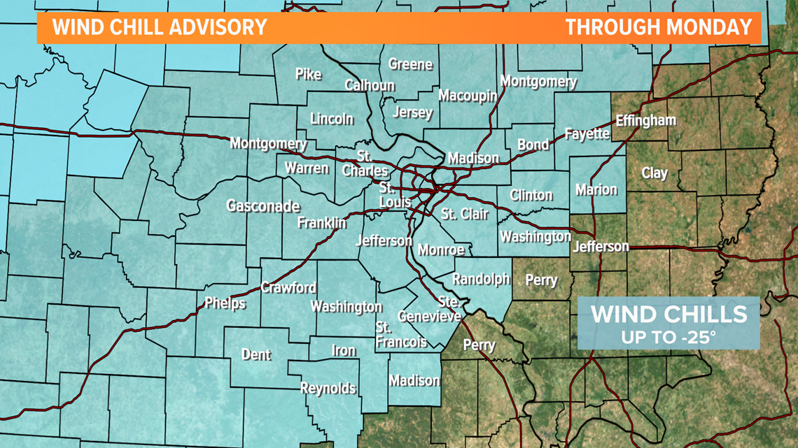
Limit time spent outdoors. Cover exposed skin, like hands and ears. Extreme cold like St. Louis is seeing this weekend can lead to frostbite in 30 minutes or less on exposed skin. With frostbite, the skin gets very cold, then numb, hard, then pale. Frostbite is most common on the fingers, toes, nose, ears, cheeks and chin.


Download the free 5 On Your Side app to get the latest watches and warnings and track conditions live with our interactive radar. Use the links below to download now.
5 On Your Side news app
iPhone | Google Play
Not only will it be cold, but we'll also face more snow. Snow will be off and on throughout the day Sunday. Heavier snowfall arrives overnight Sunday into Monday. The video below is a guideline for approximate timing for the snow. Heaviest snow is indicated in the deep purple shades.
The center of the storm is a southern system that is traditionally favorable for significant snow accumulation over parts of southern Missouri and southern Illinois. The heaviest snow band with this system appears to be just south and southeast of the metro area. Subtle changes in the track of the system could push that band a bit north or south as we watch the evolution of the storm.
About an inch will fall Sunday. The Sunday night into Monday morning round will bring more significant accumulations, and totals will round out between 2 and 4 inches. A few areas, especially south of the metro, could see up to 6 inches.

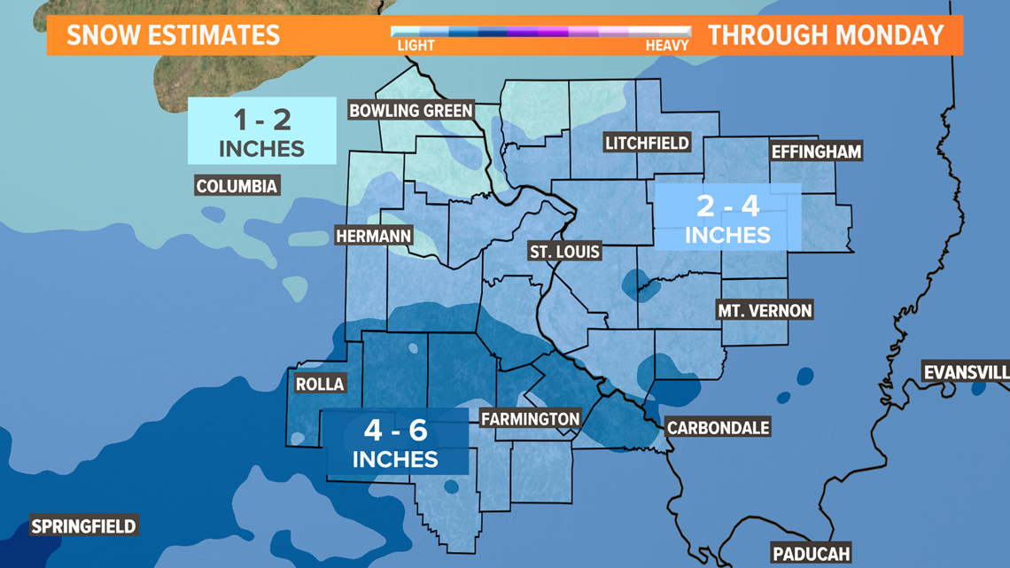
It will be a dry snow due to the frigid temperatures and will easily accumulate. It's safe to say travel will be an issue for parts of Sunday and Monday.
Yet another weather system is expected to spread snow our way toward the middle of next week which could add to the snow already on the ground.
There are signs that the cold pattern will ease a bit starting next weekend, although temperatures will likely remain below average until most of the snow is melted.
