

ST. LOUIS — We've had no shortage of really cold air recently. Temperatures below 0 for several mornings and wind chills around 20 below 0 have been pretty common the last few days.

But things will change for us over the next few days, as a more active pattern sets up. This system out west will finally start to usher some warmer air in, but also brings moisture in at the same time.
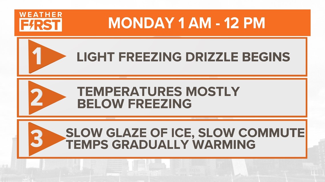
That's where things get a bit more interesting Monday morning.
Get the latest conditions and updates on Today In St. Louis on Monday morning through 8 a.m.
As temperatures are much warmer than they've been in recent days, they're still going to be below freezing at the surface. But a warmer layer of air a few thousand feet above the surface looks to keep things liquid this time around. As this rain falls into the thin layer of colder air before it reaches the surface, it becomes supercooled. Once it falls to the surface, it coats anything on contact with a thin layer of ice over time.

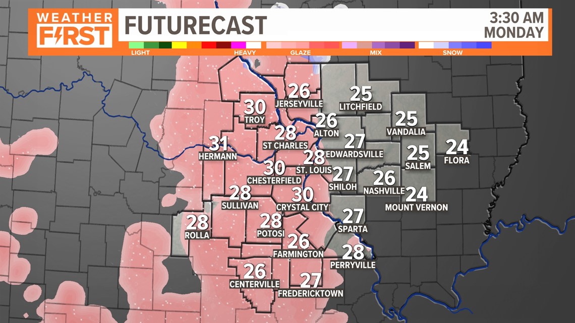
That's where the glaze of ice comes into play as freezing rain is in the forecast Monday morning. As a wide area of freezing rain moves into the area early Monday, temperatures are expected to be well below freezing. As this light coating of ice forms, this could really impact your morning commute.

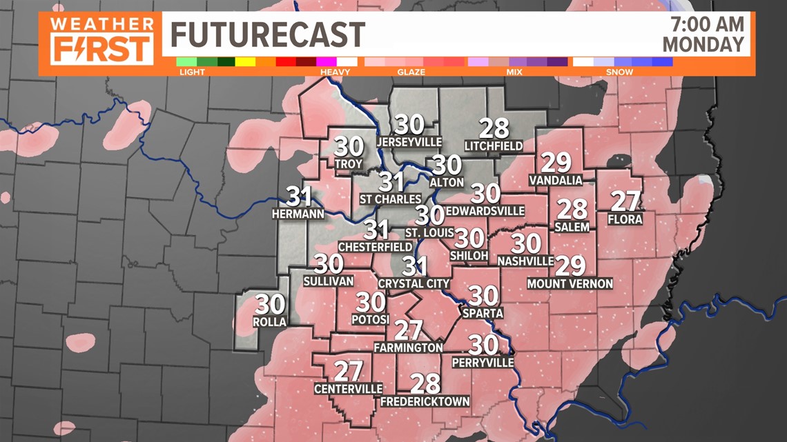
Freezing rain continues as the sun rises Monday morning, but temperatures continue to remain below freezing during this time. As this rain falls, the light glaze of ice on the roads, trees, and car surfaces will start to gather.


As the day goes along, temperatures are much closer to the freezing mark, and eventually rise above it. At this point, our roads should start to improve as precipitation changes to just regular rain.


Forecast ice accumulation is mostly around 0.1 to 0.2" of ice. But what does this really mean? It's always difficult to actually quantify how this will impact you, especially since no one is really going out there to measure it.

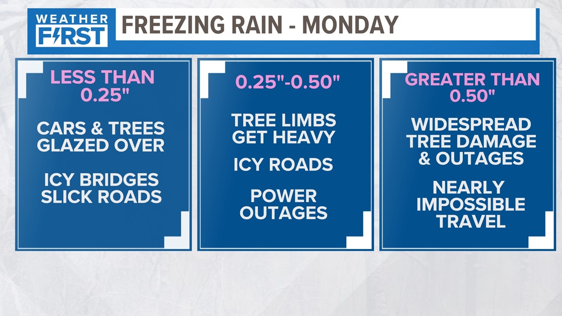
Probably the best way to explain it would be how it impacts us. Most of us will probably see cars and trees glazed over. Bridges will be the first things to ice over, with slick spots developing on the roads pretty quickly. It does not take much ice for very slick conditions on the roads! At this point though, power outages will be scattered. This is not a large ice storm in that regard.

The biggest issue we will have on Monday morning is the fact that this all happens when it's dark and early, and we're well below freezing. Black ice will be a major concern as slick spots develop in many locations before dawn. This will be the main concern as this is mostly occurring during the busiest commute times. We will keep you posted with any changes to this forecast the rest of the weekend.
