

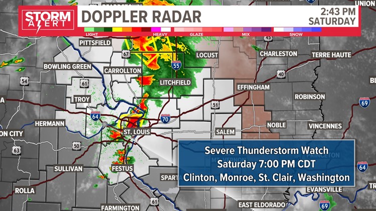
ST. LOUIS — A Severe Thunderstorm Watch is active until 7 p.m. Saturday for a large portion of the St. Louis area. There are a few ongoing severe thunderstorm warnings currently as well.
With hot and humid conditions returning, each disturbance will cause isolated to scattered showers and a few thunderstorms to develop. There have also been reports of golf ball-sized hail in St. Charles County.


There were reports of standing water on area roadways Saturday afternoon, including on Interstate 70 at Union Boulevard. The St. Louis Fire Department said it received calls for vehicles stranded in water at the following areas:
- Natural Bridge & Fair
- N. Kingshighway & Bircher
- N. Kingshighway & Lexington
There is the potential for wind over 60 mph later this evening as well. Brief heavy downpours will make travel difficult and frequent lightning requires you to get indoors safely. If your area is under a storm warning, get inside and keep away from windows and doors.
The National Weather Service has canceled a tornado warning that was issued at around 4 p.m. for Madison County, Illinois. At around 4 p.m. a trained National Weather Service storm spotter had observed a rope tornado North of Worden, Illinois.
LATEST HIGH-RESOLUTION MODEL FORECAST FOR THE NEXT 12 HOURS:
Scattered storms are expected to continue through the weekend. While there will be more dry time than rain, the chances of showers and thunderstorms look a bit higher Sunday afternoon into Sunday evening. This is when the pattern shifts to a cooler and drier set-up early next week.
