

ST. LOUIS — More storms are on the way, but the severe threat will be limited. Storms to our west will lose momentum as they track toward St. Louis. There is a second wave that could produce isolated severe storms.
Plan out your day using our storm tracker:
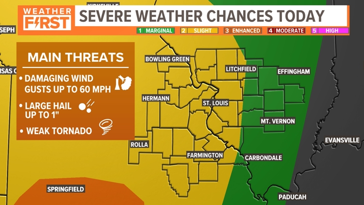
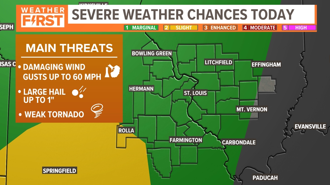
The Storm Prediction Center has shaved back the "slight" risk for most of the 5 On Your Side Coverage area. Now most of us are under "marginal" risk for severe storm development. The threats today are isolated 1" hail, wind gusts up to 60 mph and weak tornadoes.

The Weather First Team will use "Storm Alert" to refer to life-threatening or major-impact weather conditions in our region. "Weather Alert" refers to nuisance or disruptive weather and is indicated by orange icons and bars in our weather graphics on TV and online.
It's no secret that April and May are the peak months for severe weather across the St. Louis region. While severe weather can and does occur year-round in St. Louis, this is the time of year when the ingredients for severe weather come together more often.
Historically, 43% of all tornadoes in St. Louis have occurred during April and May.
Through the middle of April, more than a dozen tornadoes have been confirmed this year including nine with last Thursday's severe weather. While it is too early to be specific about the severe weather threats for later this week, the ingredients seem to be coming together. A series of strong upper-level disturbances will move through the middle part of the country into Sunday night.
The weather pattern should ease a bit after the showers and thunderstorms move out early Monday.
