ST. LOUIS — UPDATE: The severe weather threat is wrapping up for the St. Louis region, but scattered showers are still possible throughout the day on Tuesday.
Overnight storms brought upwards of 2 to 3 inches of rainfall. A Flash Flood Warning remains in place until 7 a.m. Tuesday.
PREVIOUS: The National Weather Service issued a Tornado Warning until 2 a.m. including Bonne Terre, Desloge and Terre Du Lac.
A Tornado Watch remains in place for most of the St. Louis area until 3 a.m.
The National Weather Service's St. Louis office experienced data issues overnight during the severe storms and was receiving backup from the NWS office in Kansas City.
The Weather First team is in Storm Alert as severe weather chances are increasing across the area north of St. Louis this afternoon and across the rest of the area into the evening hours. The Storm Prediction Center has the St. Louis area at a level three risk (out of five) for severe weather.
A Tornado Watch is in effect for much of the area through 3 a.m.
The west St. Louis County area appeared to be one of the hardest hit areas.
In Chesterfield, high winds toppled trees and damaged homes. Chesterfield was hit with strong winds and heavy rain.
The toppling trees weren't the only damage. The winds tore through a Chesterfield neighborhood ripping part of one family's roof right off their house, sending a section of the roof into the backyard.
Living here for 35 years, Nonie Gramlich and her husband Ron walked 5 On Your Side through their house to see the storm's impact.
"Then we were waiting for Wheel of Fortune to come on," Nonie said. "It was a little bit late because of the weather report. Then we heard the hail and I come to the front bedroom to look out."
They say it all started just before 6:30 p.m. Monday.
"Then I walked out toward the back of the house and there was junk," Nonie said. "We didn't know the tornado had moved until we stepped outside and tried to get one of the dogs in. Then, everything was just all over."
As rains continue, homeowners tell us they're worried about what kind of water damage is still to come.
Like the Gramlichs who were unable to get up on their roofs to put a tarp down which may make things worse on Tuesday morning.
Click here to read the full Weather First forecast.
The Weather First Team will use "Storm Alert" to refer to life-threatening or major-impact weather conditions in our region. "Weather Alert" refers to nuisance or disruptive weather and is indicated by orange icons and bars in our weather graphics on TV and online.
The better chance of more widespread thunderstorms, some strong to severe, will be through the late evening and continuing toward midnight. These are the storms that will likely be the most intense. Large hail, strong winds and perhaps a few tornadoes remain a possibility.
The areas of storms will tend to morph into a complex of thunderstorms toward midnight. Hail and wind will be the main threat with a few brief spin-up tornadoes possible at the leading edge of the line of thunderstorms.
As we head into the hours after midnight, the complex of storms will move through the region and is expected to be out of our area by 2 a.m.
Again, the ingredients appear to be in place for severe thunderstorms across the St. Louis region into the evening hours. How those ingredients all come together and interact with each storm will determine how strong the storms become.
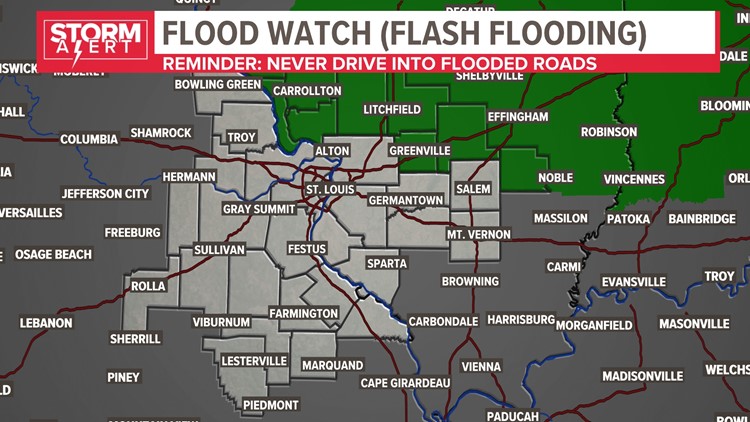
In addition, a flood watch has been issued north and northeast of St. Louis for the potential of heavier rain that may cause some flash flooding.