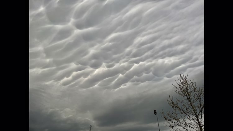
ST. LOUIS — A strong storm rolled over St. Louis Saturday evening. Hail and wind were the greatest dangers, but many communities had tornado warnings.
For the latest forecast in the St. Louis area, click here.
9:23 p.m.
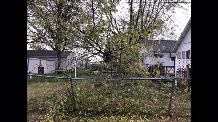
St. Louis County police reported tree damage, wires down and traffic lights flashing red. There were no reports of injuries in the storm.
9:01 p.m.
31,661 Ameren Missouri customers had lost power
11,767 w/o power in Jefferson County
1,466 w/o power in St. Francois County
13,927 w/o power in St. Louis County
4,132 w/o power in St. Louis City
4,508 Ameren Illinois customers without power in St. Clair County
8:47 p.m.
CITY SC announced the match would start at 9:49 p.m.
8:32 p.m.
Multiple reports of damaged buildings and power lines down in Hecker, Maeystown and Valmeyer in Monroe County, Illinois.
8:30 p.m.
Photos show the extent of damage to a building in Sullivan, Missouri.
8:19 p.m.
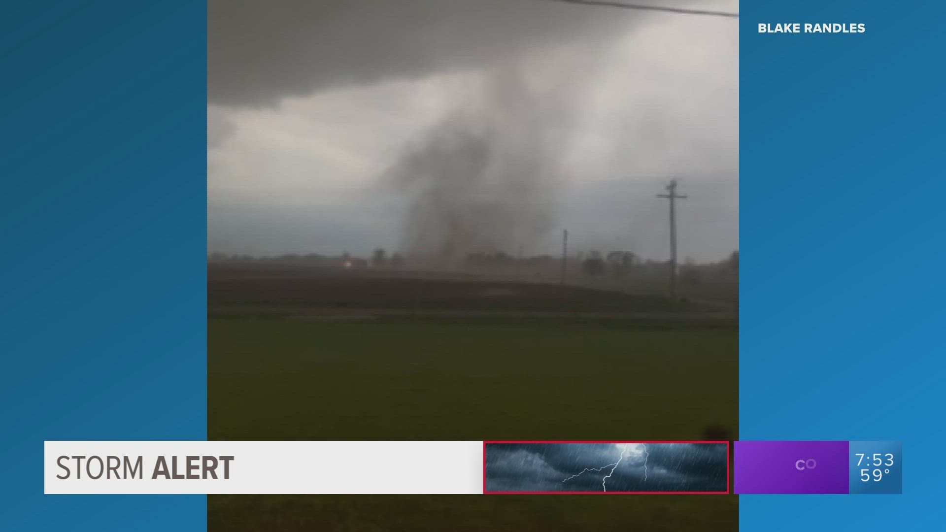
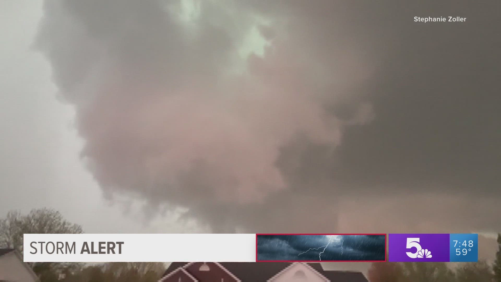
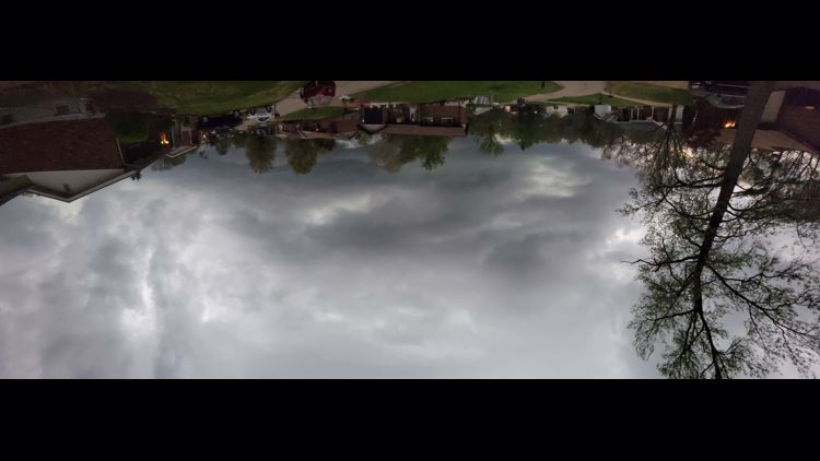
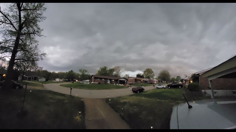
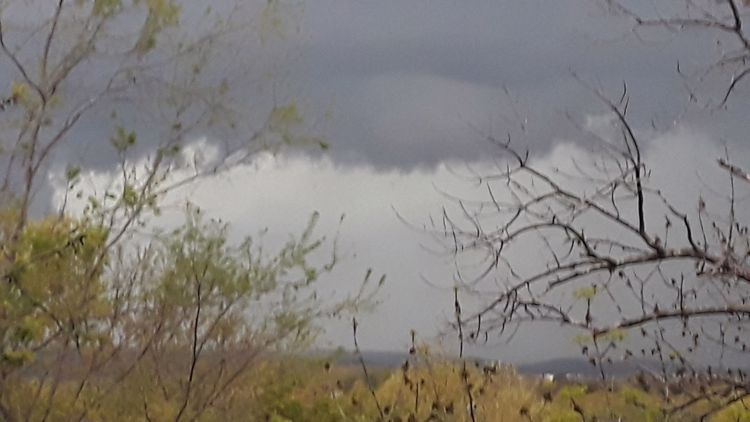
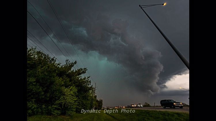
Videos showed the view of the storm in Missouri and Illinois, including potential tornado touchdowns.
The storm was weakening and the danger was decreasing.
8:16 p.m.
Some severe thunderstorm warnings were still in effect on the eastern edge of the storm that had rolled over St. Louis. The warning was in effect through 8:30 p.m.
8:07 p.m.
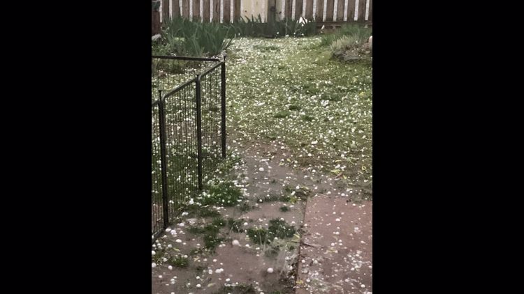
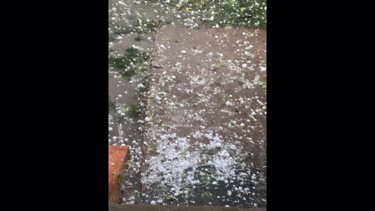
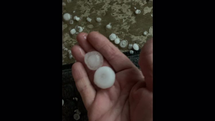
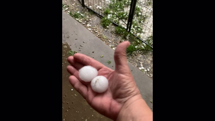
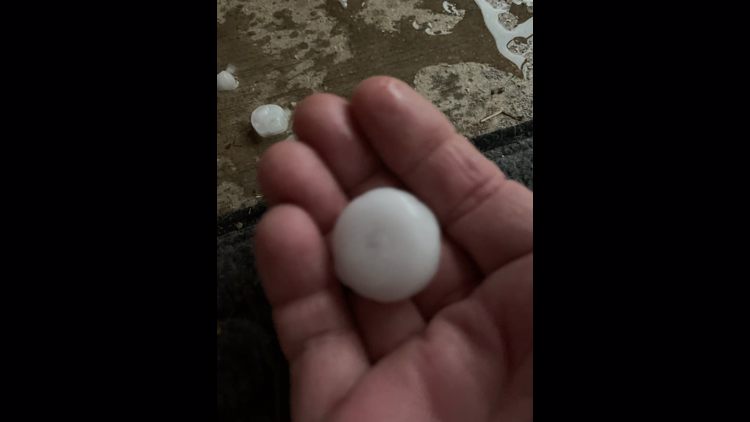
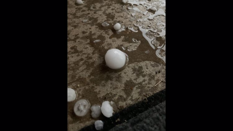
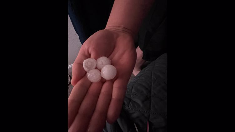
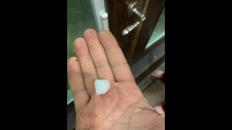
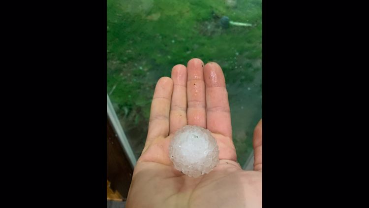
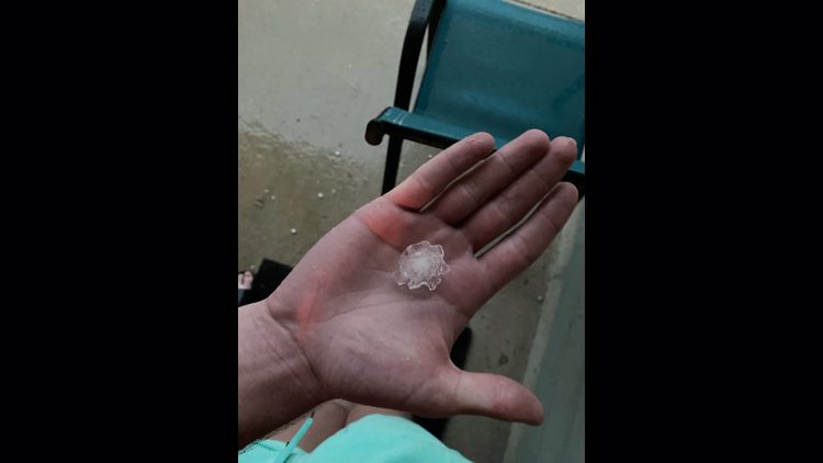
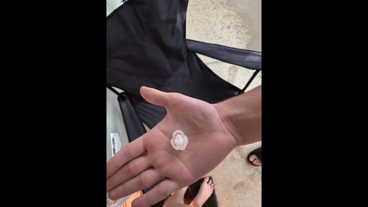
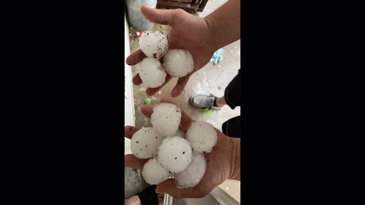
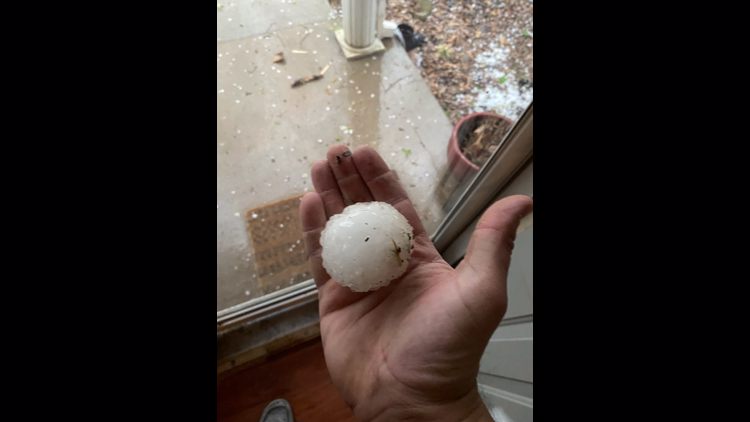
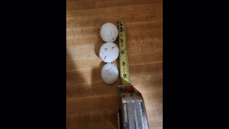
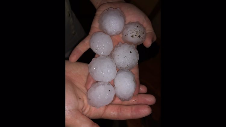
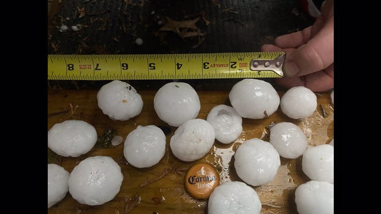
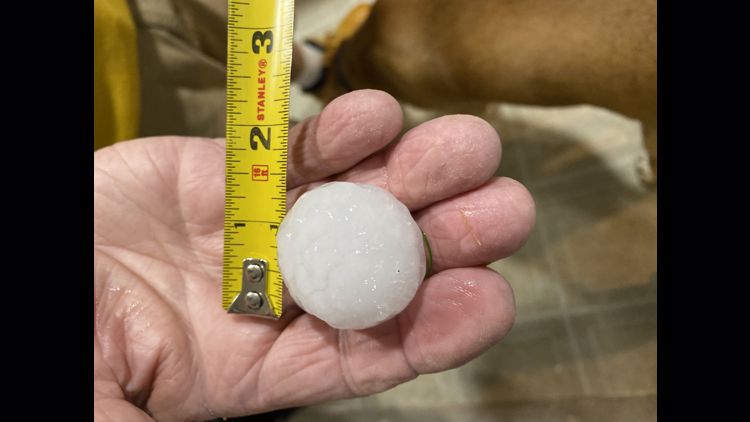
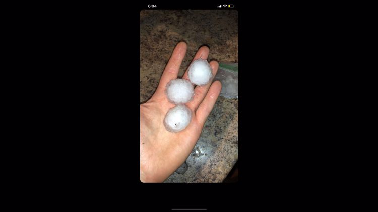
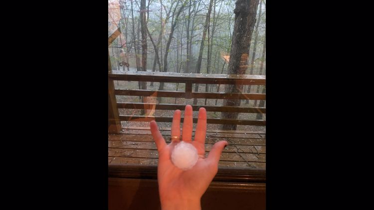
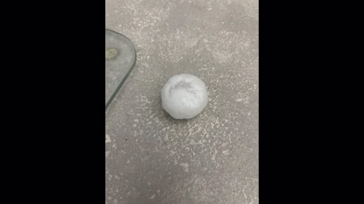
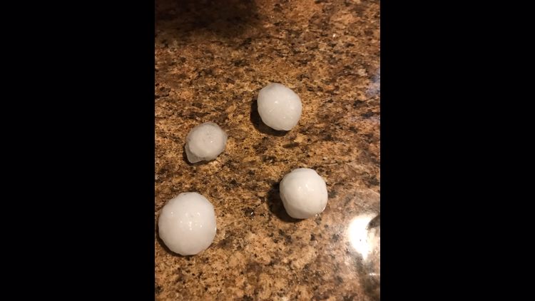
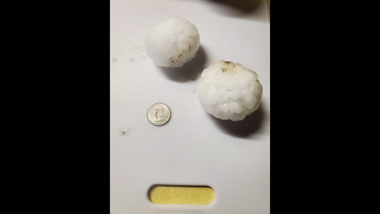
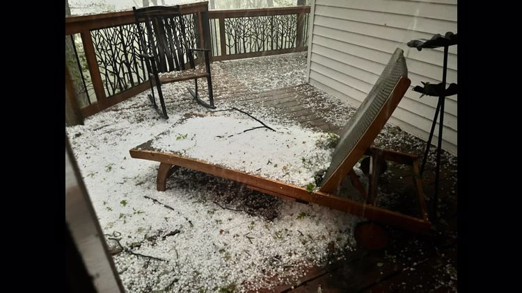
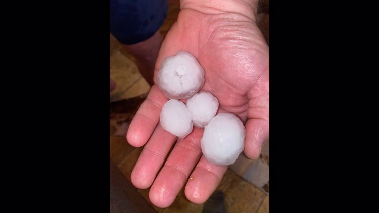
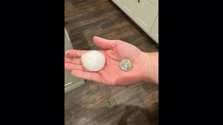
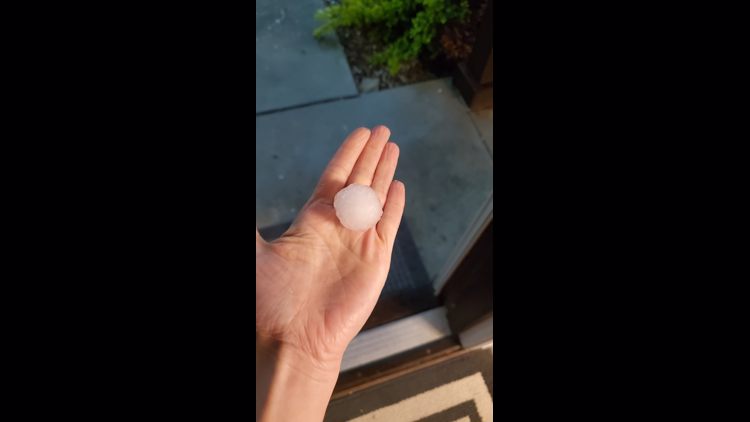
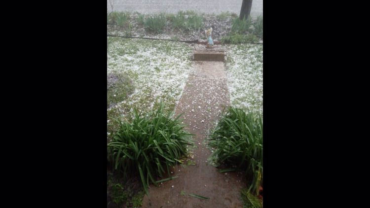
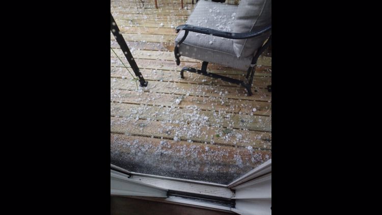
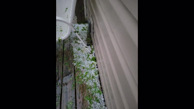
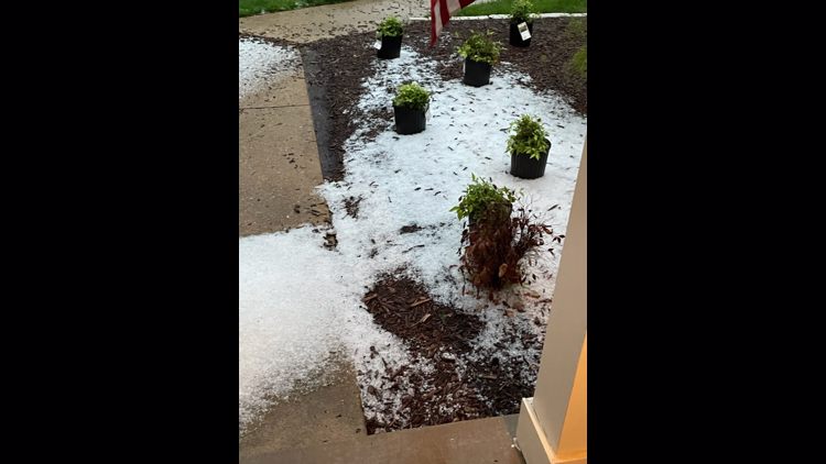
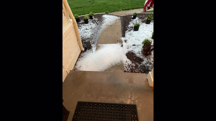
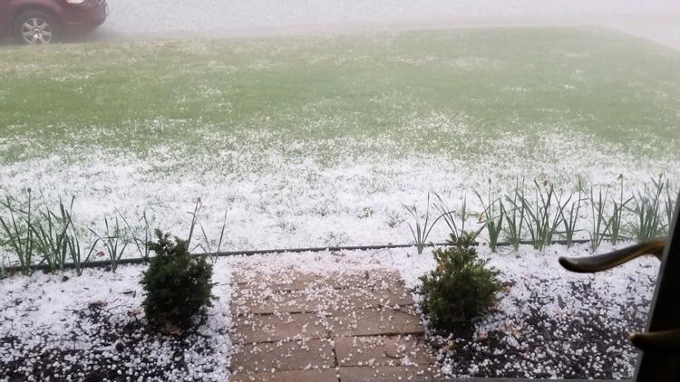
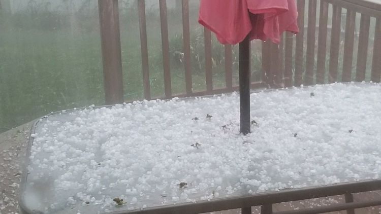
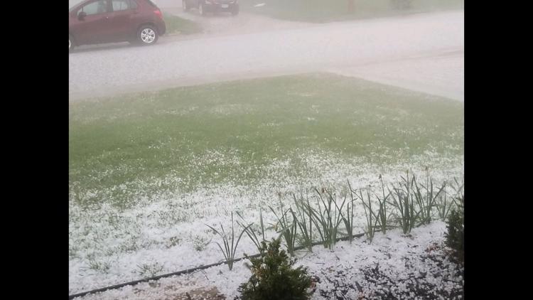
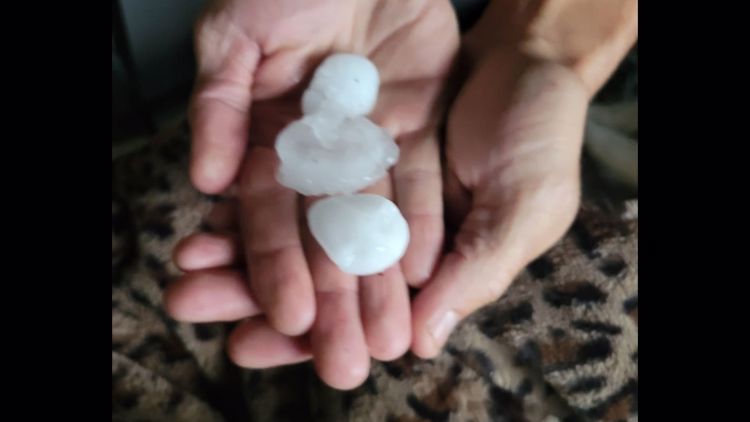
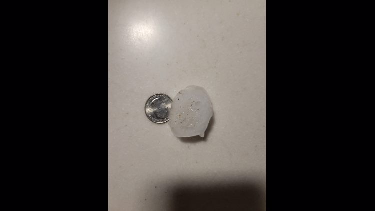
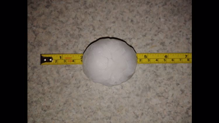
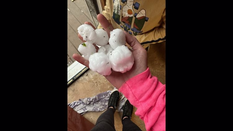
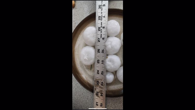
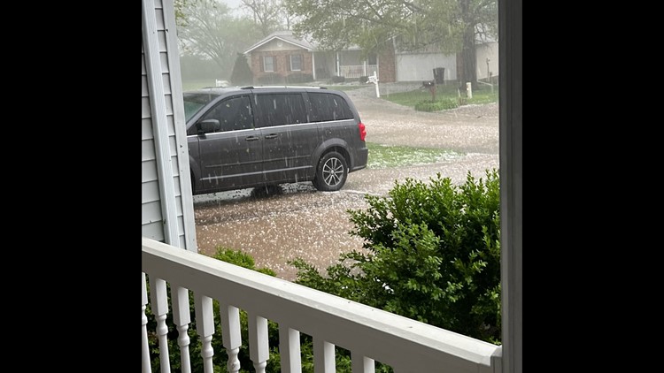
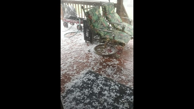
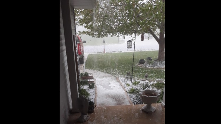
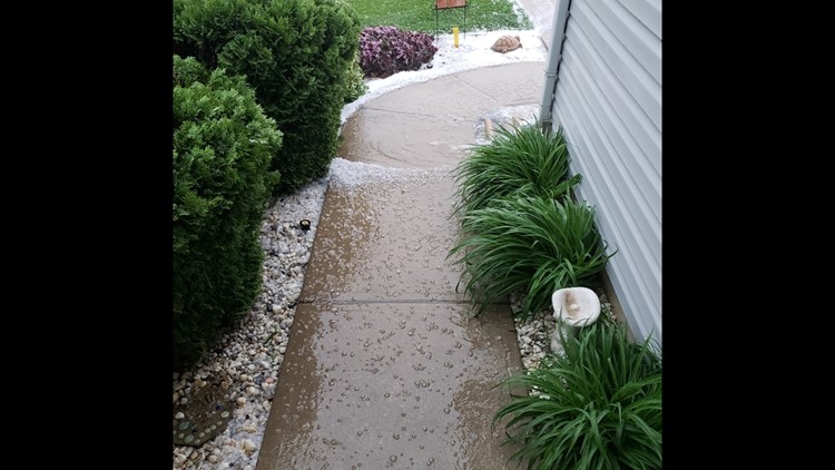
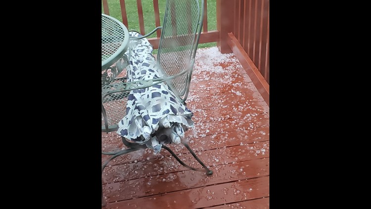
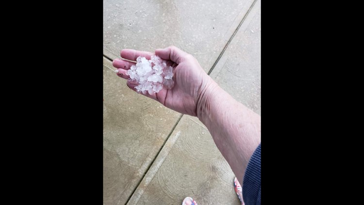
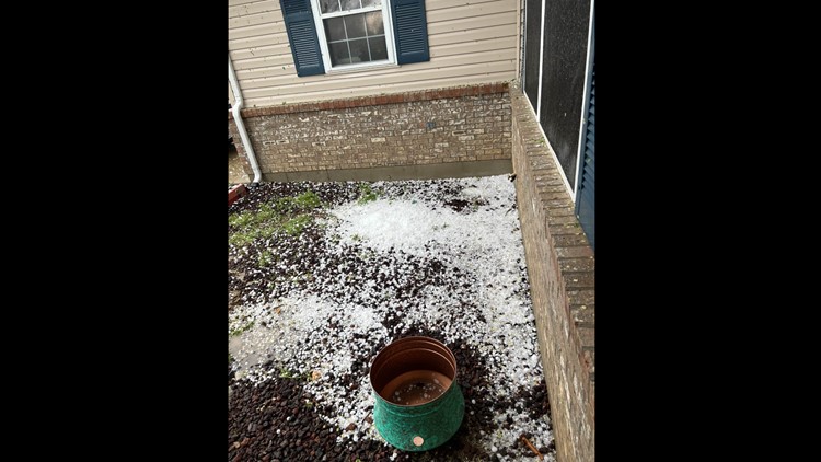
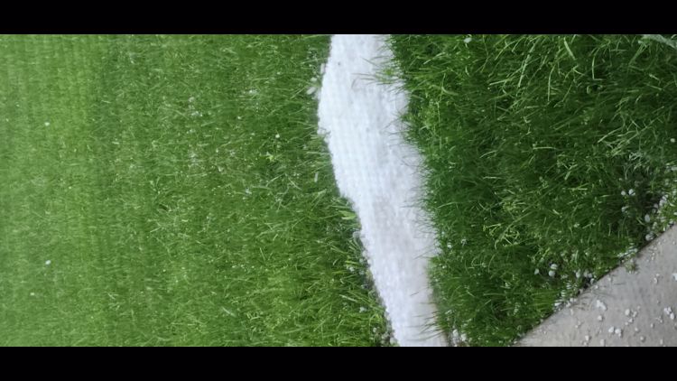
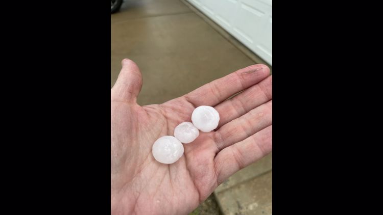
Photos show hail, lightning and damage around Missouri and Illinois.
Viewer photos: Hail around St. Louis region


8:02 p.m.
Storms are weakening but there is still heavy rain and lightning in the region.
7:54 p.m.
From MetroTransit: MetroLink is currently not operating between the Memorial Hospital and Shiloh-Scott MetroLink Stations in Illinois due to a power issue. MetroLink Station Shuttles are transporting riders by bus between the Memorial Hospital, Swansea, Belleville, College and Shiloh-Scott Stations. Delays of 30 to 60 minutes possible if traveling through this area.
7:45 p.m.
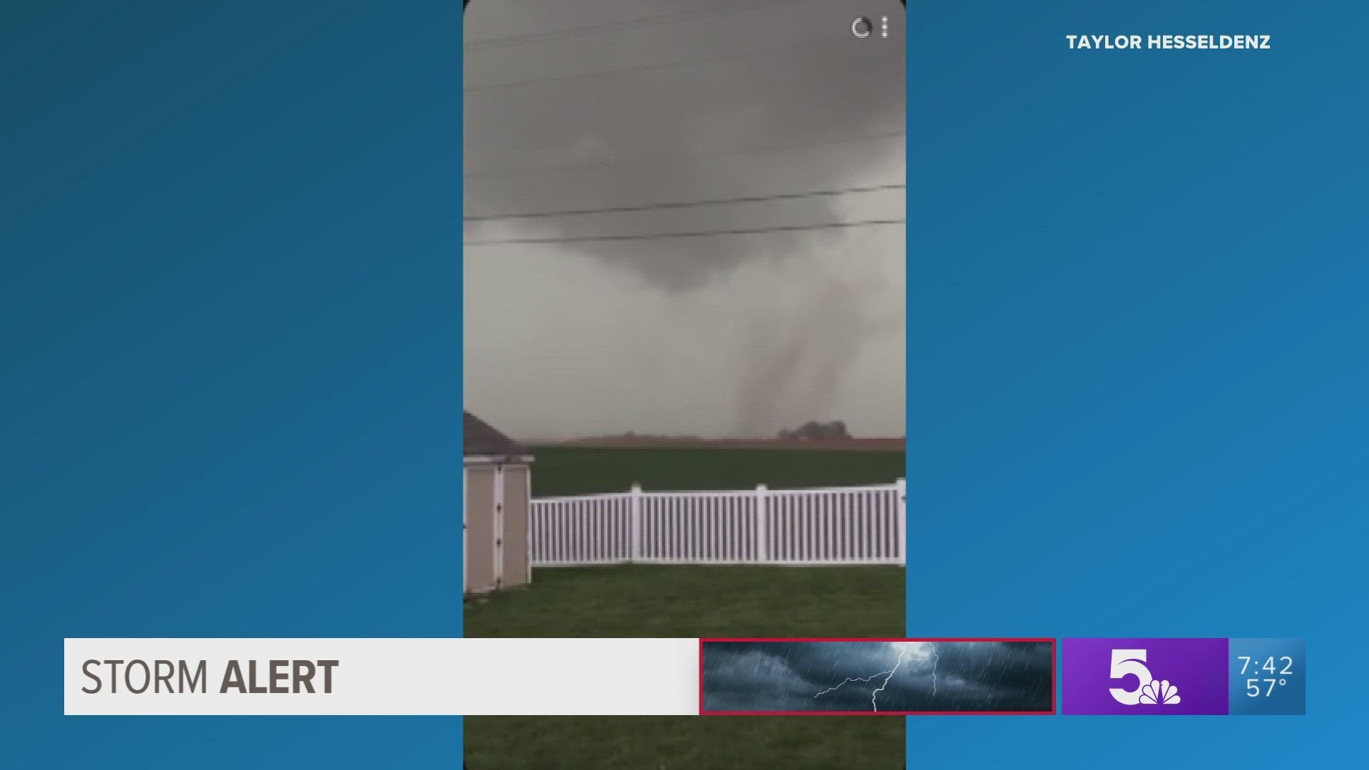
Video appeared to confirm a tornado in Waterloo, Illinois.
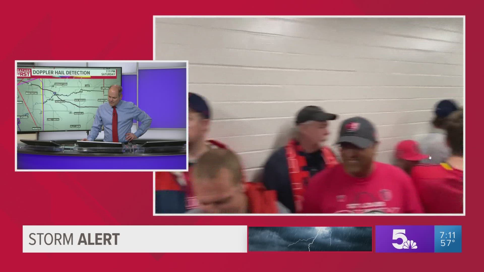
Video shows CITY SC fans sheltering in place at CITYPARK.
7:42 p.m.
Crews from Ameren are just getting to affected areas to assess the damage and restore power.
7:39 p.m.
The storm continued to push east while it weakened.
There were reports of 60+ mph winds around St. Louis.
7:31 p.m.
CITY SC announced a weather delay due to lightning.
7:28 p.m.
The tornado warning continued for New Baden and Carlyle until 8 p.m.
7:26 p.m.
The tornado warning continued for Bethalto until 8 p.m.
7:24 p.m.
The tornado warning continued for O'Fallon, Illinois, Collinsville and Edwardsville.
7:21 p.m.
The severe weather threat is greatly reduced five to ten minutes after the storm arrives in a community. It is moving quickly over the region.
There were circulations seen on radar, but no debris fields were seen at 7:21 p.m.
7:14 p.m.
Scroll down for the active tornado warnings.
The Ballwin Rec Center was damaged in the storm Saturday night.

7:08 p.m.
A tornado warning was continued for Granite City, O'Fallon, Illinois, and East St. Louis.
7:03 p.m.
Tornado warning was continued for Belleville, Mascoutah and Freeburg.
6:56 p.m.
Tornado warnings continued for a few areas in St. Louis and the Metro East.
There was a tornado confirmed in southern St. Clair County.
Other areas were under severe thunderstorm warnings.
6:52 p.m.
There were multiple reports of damage in the region. Share your photos with 5 On Your Side by texting us at 314-425-5355.
6:40 p.m.
The tornado warning includes St. Louis and parts of the Metro East.
6:32 p.m.
There was a confirmed tornado in Valley Park and moving toward Kirkwood.
Go to your safe space if you are in an area with a tornado warning.
6:19 p.m.
There was a tornado warning for parts of St. Louis City and St. Louis County.
6:08 p.m.
A tornado warning was issued for parts of Franklin and Jefferson counties.
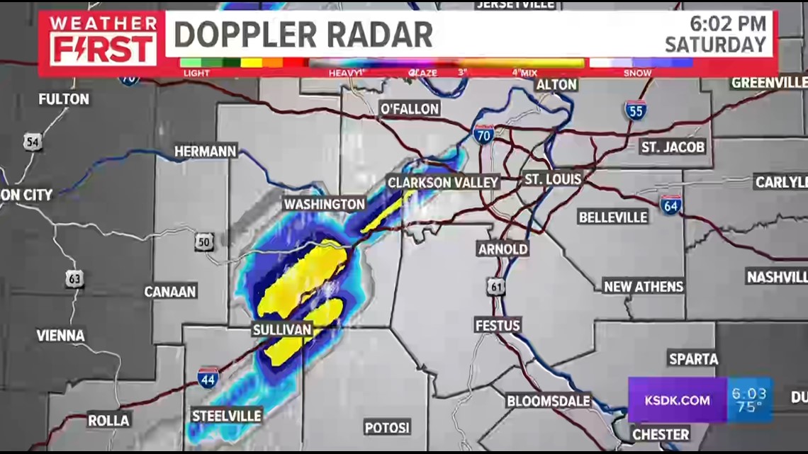
6:03 p.m.
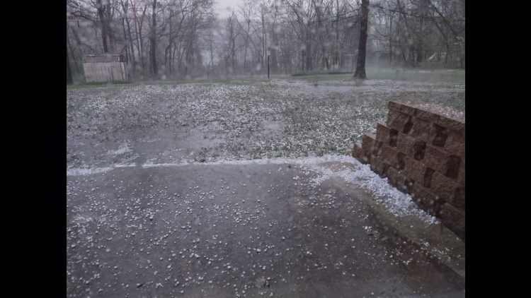
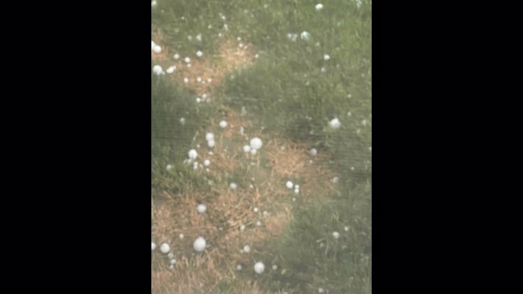
These tracks show where hail has fallen in these storms.

5:59 p.m.
People east of Highway 141 have a few minutes to move their cars to a safe place to minimize the risk of hail damage.
5:53 p.m.
A Sullivan business lost its roof, emergency management tells 5 On Your Side.
A new severe thunderstorm warning was in effect for parts of Jefferson, Franklin, St. Louis and Washington counties.
5:52 p.m.
Traffic was at a standstill on Interstate-44 near Six Flags. Do not stop under the underpasses to shelter from hail. Get off the highway if possible.
5:50 p.m.
Storms are lining up west of the metro area. High winds and large hail are the threats for damage. The storms will move west to east over the St. Louis area over the next few hours.
5:39 p.m.
Some areas of the metro area could have large hail. Stay away from windows.
Severe thunderstorm warning includes a large section of St. Louis County.
This photo is from earlier in the afternoon in Japan, Missouri.


5:29 p.m.
A flash flood warning was issued for Union, Pacific and Gray Summit, Missouri, until 10:30 p.m.
5:28 p.m.
Gusty winds are the chief concern for the storm moving west to east. Heavy rain was falling in Wentzville.
5:18 p.m.
Most of the storms have formed a line moving west to east. This kind of storm means straight-line winds could be a danger, but the storms will move quickly over any individual area.
All tornado warnings expired.
5:14 p.m.
The severe thunderstorm warning centered on Sullivan, Missouri, was the greatest concern.
5:08 p.m.
Vichy and Rolla areas have reports of large hail.
Oak Hill could see baseball-sized hail.
4:49 p.m.
A tornado warning continued for Cuba, Missouri and other communities.
4:37 p.m.
A tornado warning has been issued in parts of Phelps County until 5:15 p.m.
A tornado watch was issued for St. Louis through 10 p.m.
Previous updates

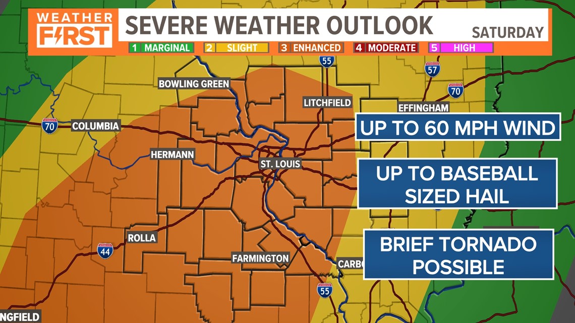
We've been upgraded to an Enhanced Risk for severe weather Saturday afternoon. The most significant message from today's severe weather is the potential for very large hail later on this evening.

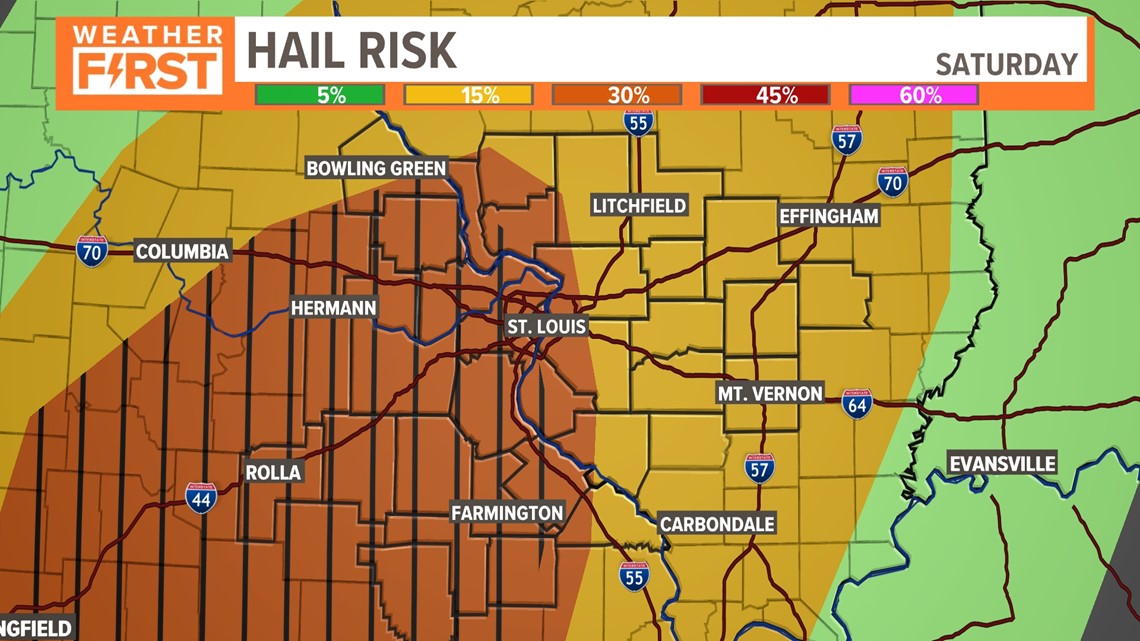
This map outlines the higher chances for not only 1"+ diameter hail, but a large area of greater than 2" diameter hail later on this evening as this line of storms develops.

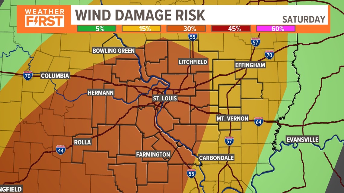
Our wind risk is very similar as well, with higher opportunities for straight line wind gusts as well. 40-60+ wind gusts are expected later this evening as the cold front approaches.
Between 3 and 5 p.m., this line of storms will develop west and continue to move east, impacting all of our area. Expect the majority of our area to be under a Severe Thunderstorm Watch at this point.
As this line races east, they will most likely impact the St. Louis metro area around sunset.

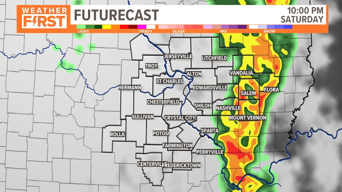
Storms continue to move through the metro east and will fully be on the Illinois side by 11 p.m.. These storms are not something you'll need to worry about overnight as the cold front has fully moved through.

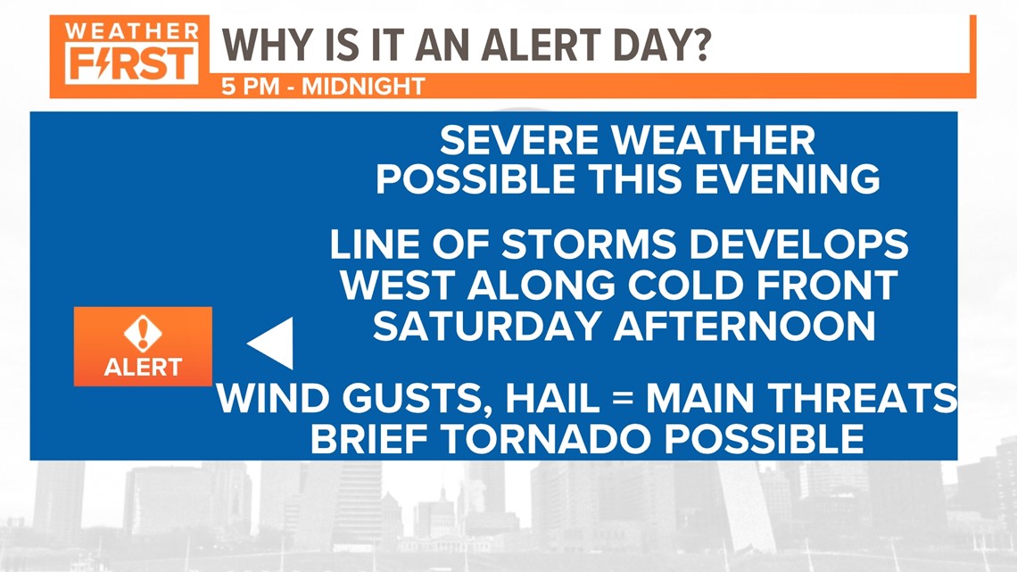
We're under a Weather Alert right now, but that will likely change later to Storm Alert. Severe weather will develop later this evening along a cold front. Up to baseball sized hail, wind damage, and brief tornado is possible. We'll update you throughout the day as watches and warnings are in place once storms develop.