
Information as of 3 p.m. Tuesday:
5 On Your Side is in Storm Alert as a variety of winter weather develops from Tuesday through Thursday across a large portion of the middle Mississippi River valley.
The system has latched onto abundant moisture from the Gulf of Mexico at the same time a surge of arctic air continues to plow south from Canada and the collision will provide quite a wintry mess across the region.
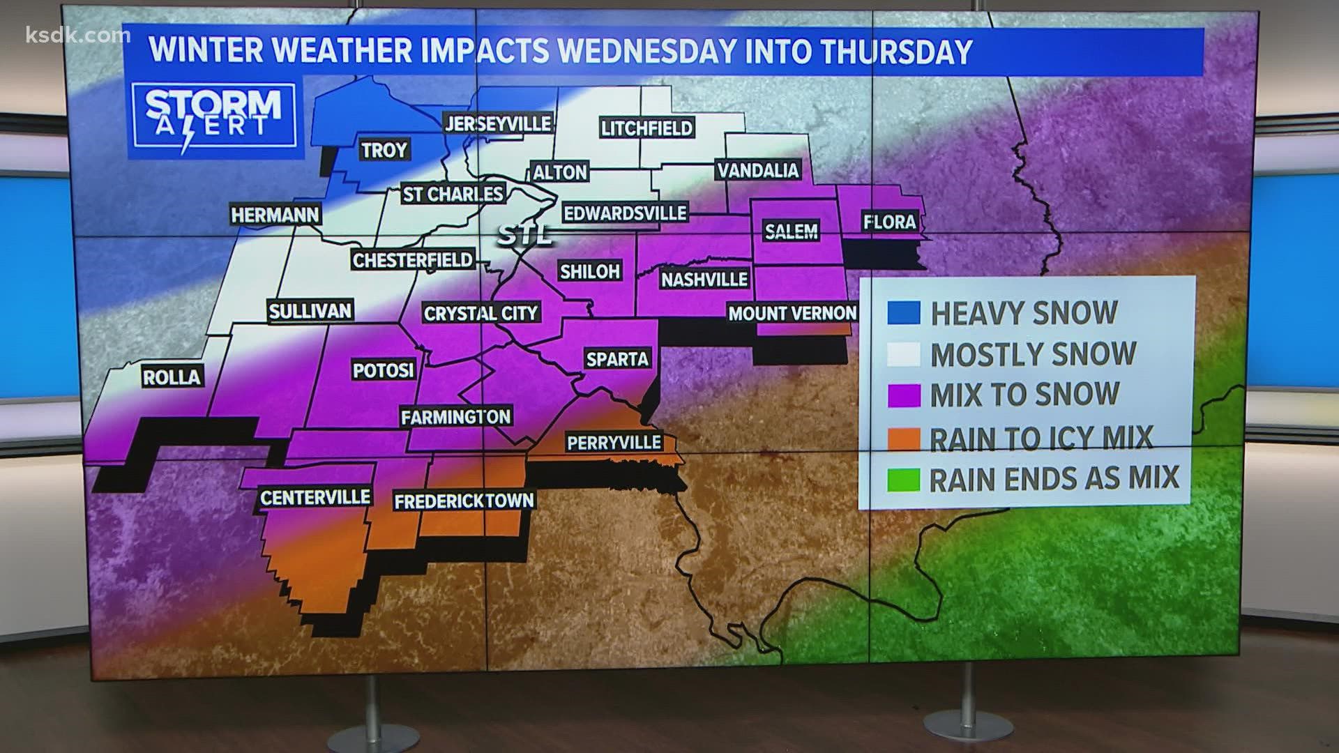
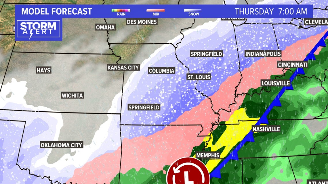
The battle zone sets up across Missouri and Illinois from later Tuesday evening into Thursday as the cold air sags southeast. Significant snow will fall to the north and west of St. Louis and perhaps to include much of the metro area with the transition zone of an icy wintry mix from the metro area and to the south and east as the colder air moves in.
The end result is major travel complications across the region.

Download the free 5 On Your Side app to get the latest watches and warnings and track conditions live with our interactive radar. Use the links below to download now.
5 On Your Side news app
iPhone | Google Play
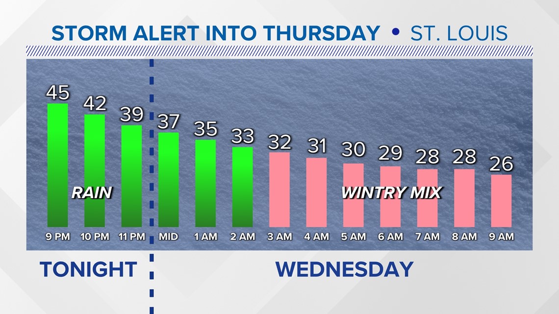
The cold arctic air will be spilling into our area during the overnight hours early Wednesday morning.


There will be two waves of sloppy weather for a good portion of Mid America through the middle of the week. The first happening during Wednesday with conditions deteriorating during the morning rush hour.

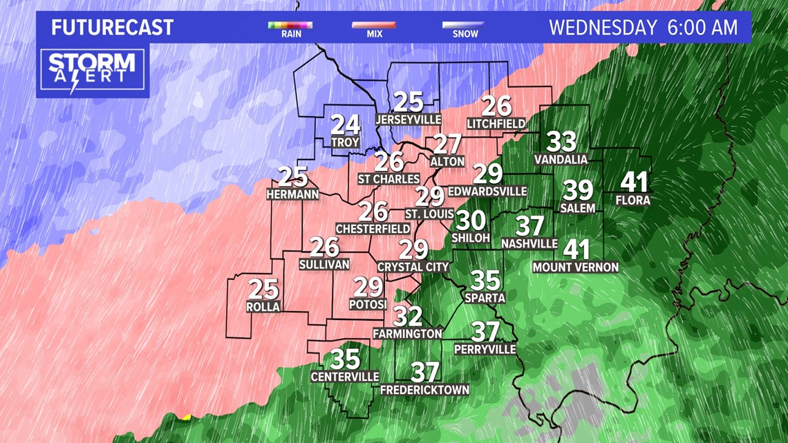
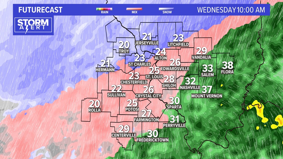
By lunchtime Wednesday, the cold air will be deep enough for mostly snow across the metro area with a mix of freezing rain and sleet for areas southeast of St. Louis.

Stream 5 On Your Side: To add the 5 On Your Side app to Roku or Amazon Fire TV, search for "KSDK" to find the free app to add to your account. Get weather updates, the latest local news and special reports from 5 On Your Side.
On the warmer side of the storm system, heavy rainfall can be expected over far southern Illinois and the Bootheel of Missouri before the cold air arrives to create a glaze of ice.


RELATED: Check our live interactive radar
Another surge of heavier snow and sleet is expected to move into the St. Louis area very late Wednesday night into Thursday morning. This may be mostly snow for much of the metro area.

Total sleet and snow accumulations ranging from an inch or two far southeast to as much as 18 inches north of a line from Jerseyville to Troy to Hermann.

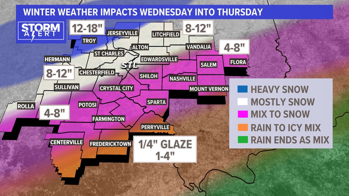
There may be enough ice to cause a few downed power branches and isolated power outages over far southeast Missouri and southern Illinois as the winds become a bit gusty where ice accumulates on the trees and powerlines.
Travel impacts are expected over portions of eastern Kansas, Missouri, Illinois and Iowa and into the Great Lakes as the system evolves. Once the system moves away, the arctic chill will linger into through the end of the week with temperatures well below average for early February.