
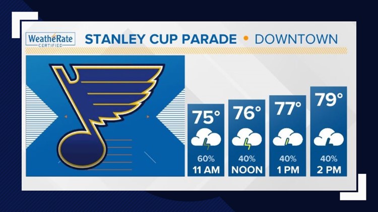
ST. LOUIS - Showers and thunderstorms will move through the area this morning and last until the early afternoon.
Some of the storms that move through will bring gusty winds to the area & some small hail. Gusty winds will be the biggest threat this morning, so if you are heading into downtown and will be hoisting a tent, make sure to have it anchored down in the case of heavy winds.
If you're heading downtown for the parade, click here for the guide with everything you need to know
Aside from storms this morning, the day ahead will warm up in the lower 80s, but skies will stay mostly cloudy before another round of rain and storms move in this evening around dinner time and into the overnight hours. Some of those storms that move through in the predawn hours of Sunday morning could be strong as well.
A flash flood water is also in effect for areas to the north and east of St. Louis metro. These areas could see upwards of 3 inches of rain today and overnight. The flash flood watch is in effect through Sunday morning for our Illinois counties shaded in green.
This is just the beginning of a very wet pattern that is setting up across the Bi-state over the next week. Additional forecasted rain totals anywhere from 2-4 inches of rain by the end of this upcoming week. River levels that had begun to fall, will likely hold steady or begin to rise again by the end of next weekend.