ST. LOUIS — UPDATE: The severe weather threat is wrapping up for the St. Louis region, but scattered showers are still possible throughout the day on Tuesday.
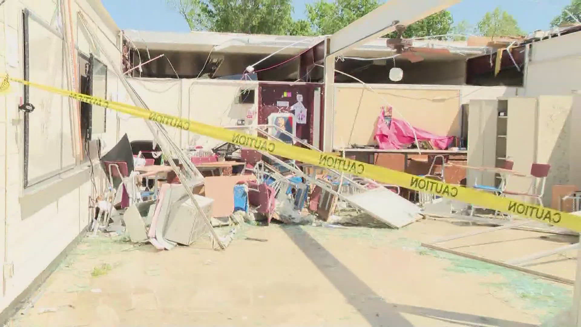
Overnight storms brought upwards of 2 to 3 inches of rainfall. A Flash Flood Warning remains in place until 7 a.m. Tuesday.
PREVIOUS: The National Weather Service issued a Tornado Warning until 2 a.m. including Bonne Terre, Desloge and Terre Du Lac.
A Tornado Watch remains in place for most of the St. Louis area until 3 a.m.
Those in affected areas should stay up-to-date with the latest weather developments and be prepared to go to your safe place if necessary. It's a good idea not to go to sleep until the severe weather threat has passed your area.
A tornado warning means a tornado has been spotted or indicated by the radar. Stay in your safe place until the threat of a tornado has passed. Have a pre-determined place to meet after a disaster. Using text messaging instead of calling on cell phones is often more successful during times of destructive weather.
The National Weather Service's St. Louis office experienced data issues overnight during the severe storms and was receiving backup from the NWS office in Kansas City.
Stay up-to-date with the latest developments as 5 On Your Side meteorologists track the storms:
Download the free 5 On Your Side app to get the latest watches and warnings and track conditions live with our interactive radar. Use the links below to download now.
5 On Your Side news app
iPhone | Google Play