
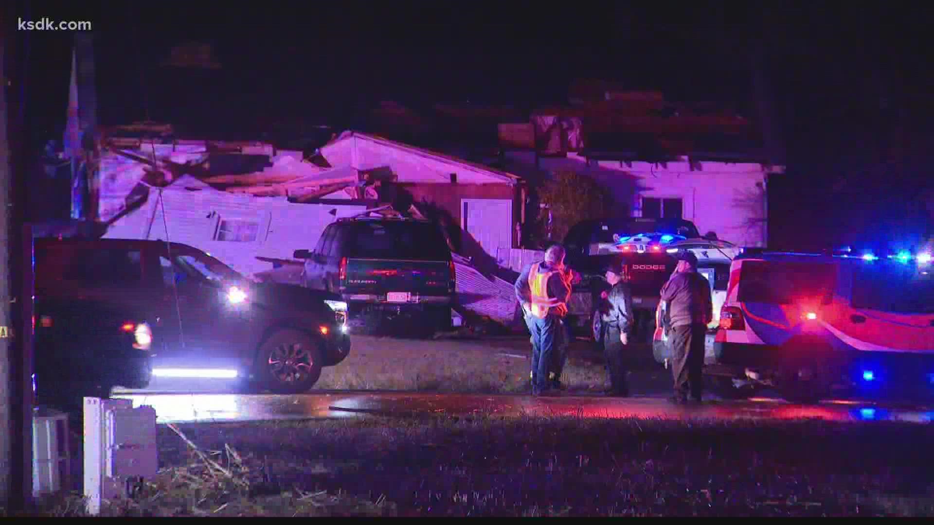
ST. LOUIS — Tornado warnings were issued for numerous counties and tornados were shown by radar to pass over Weldon Spring and Edwardsville. One person was killed in Defiance, Missouri, and two people were injured. Deaths were also confirmed at an Amazon warehouse in Edwardsville.
5:45 a.m.
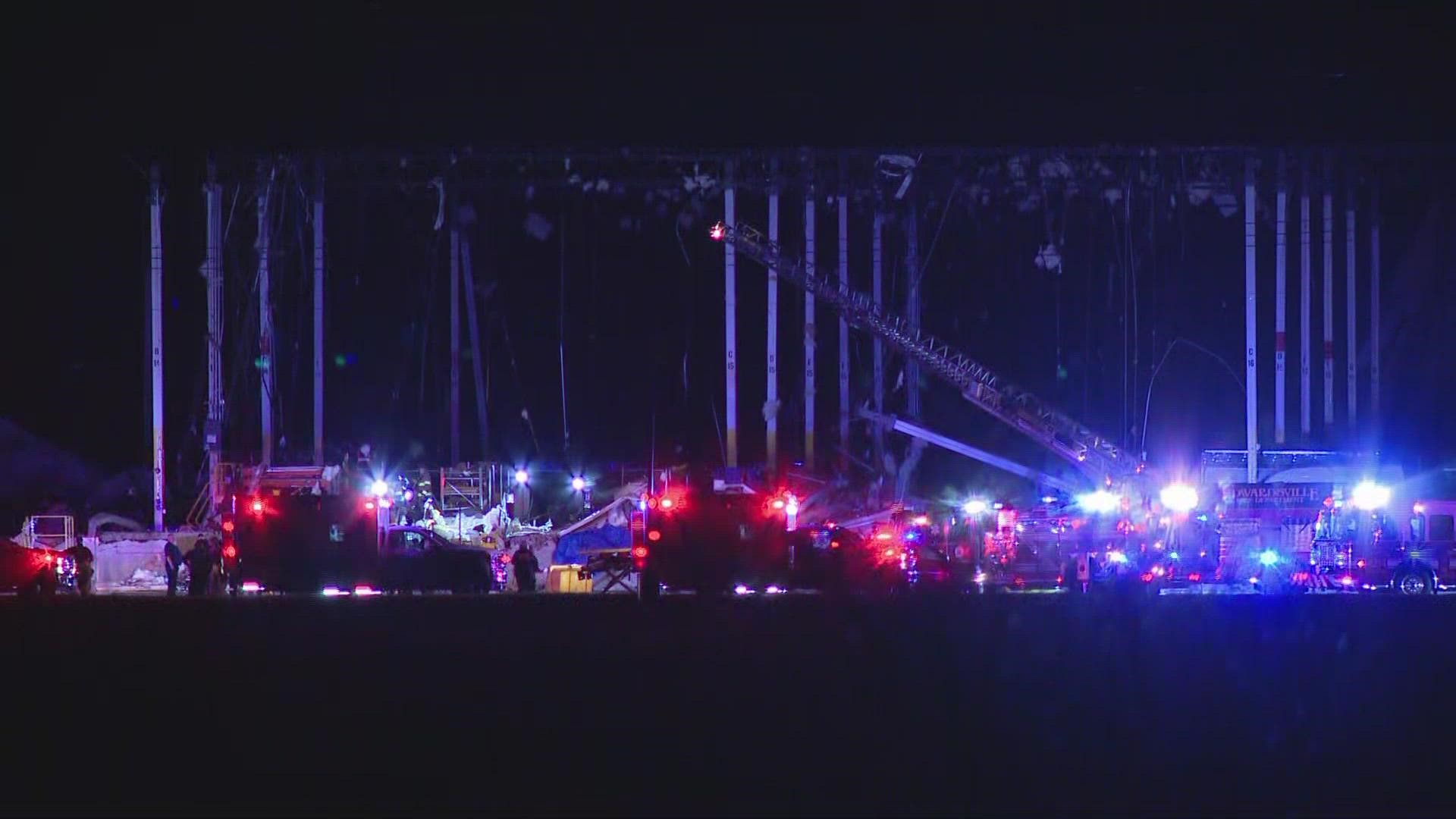
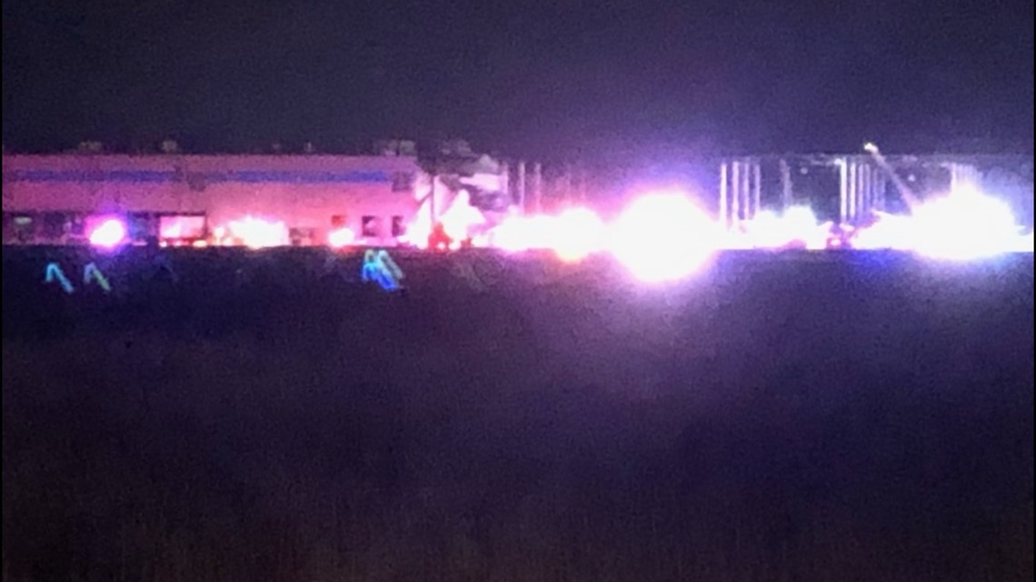
Edwardsville Police Chief Michael Fillback confirmed at a press conference that at least two people had died at the Amazon warehouse. First responders have had challenges in determining how many people were at the warehouse at the time of the storm because it has no set staff. Amazon management was at the scene Saturday morning to help create a list of who had and had not been accounted for.
3:54 a.m.
Edwardsville, Ill., police confirmed fatalities at the Amazon warehouse. Next of kin were being notified. More details were expected at a 5:45 a.m. press conference.
12:17 a.m.
Two mobile homes were destroyed in Reynolds County.
12:14 a.m.
Illinois Governor JP Pritzker activated the State Emergency Operations Center to help storm-affected areas, including Madison County, where an Amazon warehouse collapsed, trapping people inside.
The severe weather threat was ended for the St. Louis area.
12:01 a.m.
The tornado warnings in the region were allowed to expire.
11:45 p.m.
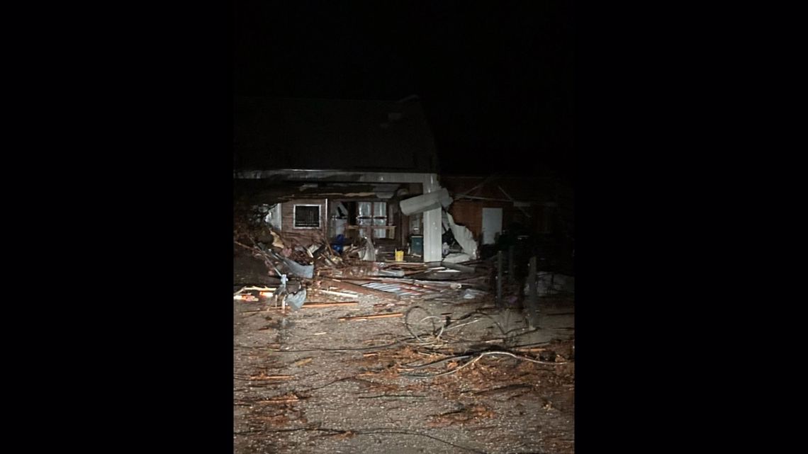
A photo showed a destroyed barn in Defiance along Highway F.

11:41 p.m.
A tornado warning was still in effect for northern Marion County as of 11:41 p.m. Other tornado warnings had expired.
11:19 p.m.
The storm threat was still high for Illinois counties east of St. Louis. People should take care to look for downed power lines, debris blown by the wind and other storm hazards.

11:13 p.m.
Tornado warnings were active as of 11:13 p.m. with threats of flying debris:
Northeastern Clinton County in south central Illinois
Marion County in south central Illinois
Northeastern Washington County in south central Illinois
Central Fayette County in south central Illinois
11:10 p.m.
The storm in Defiance resulted in the death of one person and two other people were injured.
11:07 p.m.
A tornado warning was active for Fayette County in south central Illinois as of 11:07 p.m. with threats of flying debris.
Other tornado warnings had expired.
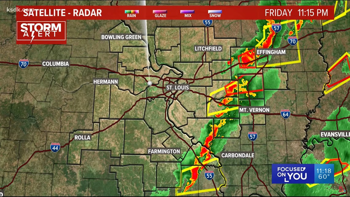
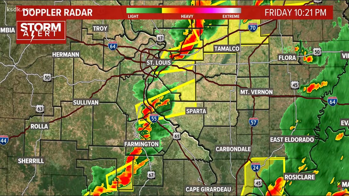
10:20 p.m.
High winds continued to pose a threat to the bi-state region. Tornadoes were still possible. Many areas were still under severe thunderstorm warnings. The threat has lessened west and north of St. Louis. The areas south and east of the region continued.

10:17 p.m.
Tornado warnings were active as of 10:17 p.m. with threats of flying debris:
Southeastern Iron County in southeastern Missouri
East central Reynolds County in southeastern Missouri
Madison County in southeastern Missouri
Northern Madison County in southwestern Illinois
Southeastern Macoupin County in southwestern Illinois
10:14 p.m.
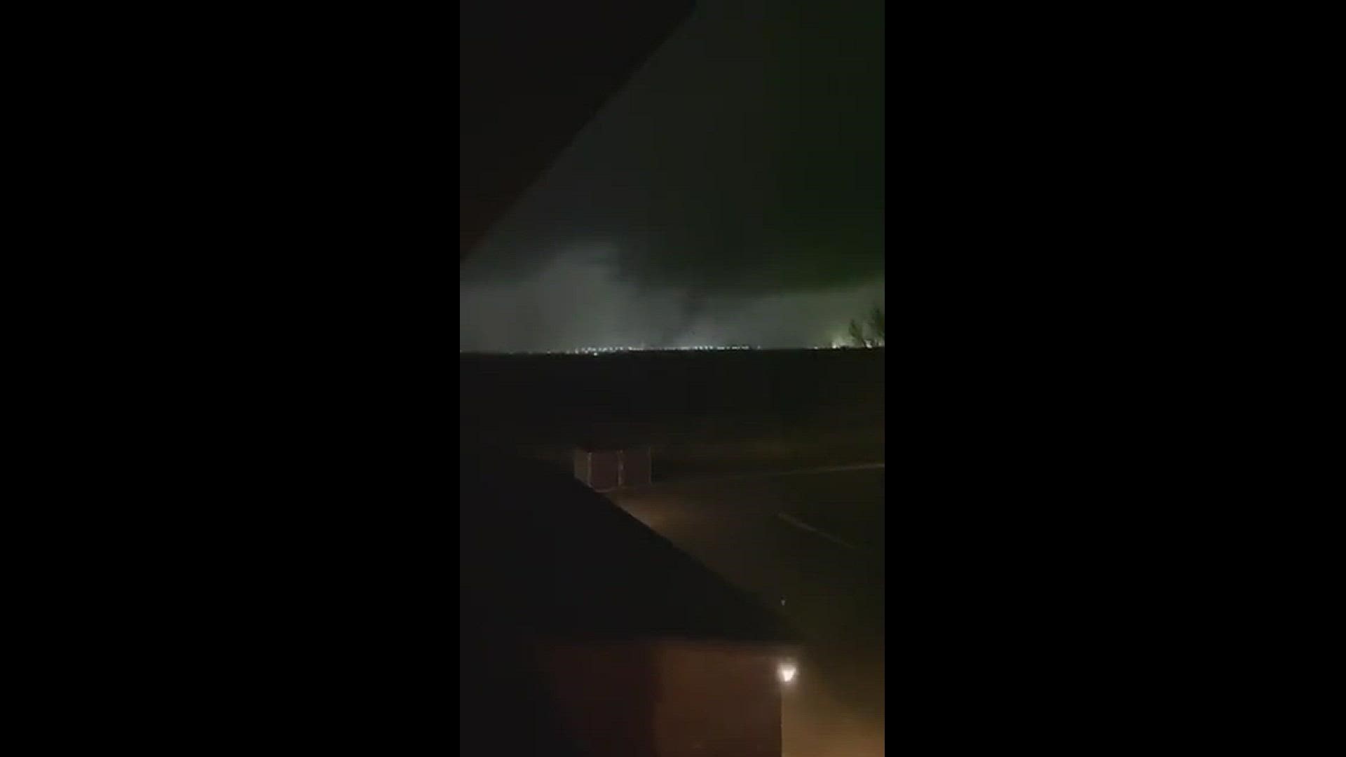
Video from a KSDK viewer showed tornadic activity in Edwardsville, Illinois.
10:00 p.m.
Tornado warnings were active as of 10:00 p.m. with threats of flying debris:
Northern Madison County in southwestern Illinois
Southeastern Macoupin County in southwestern Illinois
9:58 p.m.
Video showed the scene at the warehouse in Edwardsville.
9:53 p.m.
9:47 p.m.
A roof was ripped off an Amazon warehouse in Edwardsville. Read the latest on that developing situation here. That area is under an tornado warning, so take shelter now.
9:41 p.m.
Tornado warnings were active as of 9:41 p.m. with threats of flying debris:
Northern Madison County in southwestern Illinois
Southern Macoupin County in southwestern Illinois
Northeastern St. Charles County in east central Missouri
Northeastern St. Louis County in east central Missouri
A radar-indicated rotation was set to move over the area of St. Louis Lambert Airport.
9:24 p.m.
A photo showed massive damage to an Amazon warehouse in Edwardsville, Illinois.

Share your breaking news photos, video and news tips at newstips@ksdk.com or text 314-425-5355.
9:20 p.m.
Radar confirmed debris from a tornado in northwest Fayette County, Illinois. A tornado warning continued for the area.
9:17 p.m.
There is a major emergency response at an Amazon warehouse in Edwardsville, Illinois. This is a developing story and will be updated on KSDK.com. Thirty to 40 emergency vehicles were in the vicinity.
9:11 p.m.
Another line of storms was set to roll over the St. Louis metro area.
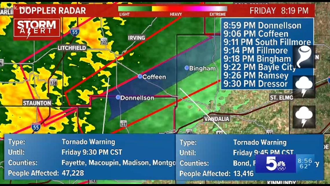
Tornado warnings were active as of 9:11 p.m. with threats of flying debris:
Franklin County, Missouri
Gasconade County, Missouri
Fayette County, Illinois
Montgomery County, Illinois
Bond County, Illinois
9:07 p.m.
Radar indicated a tornado on the ground near Coffeen, Illinois in Fayette County. Winds were moving the storm fast.
9:06 p.m.
Winds and hail were reported across the region.

9:03 p.m.
At least three people were transported to the hospital with storm-related injuries in St. Charles County according to the St. Charles County Ambulance District.
9:00 p.m.
Heavy rain and hail fall in Wentzville as sirens go off. Share your photos, video or news tips by emailing us at newstips@ksdk.com or text 314-425-5355.
8:56 p.m.
The storms continued eastward into Franklin, Gasconade and Warren counties in Illinois.


8:50 p.m.
Tornado warnings were active as of 8:50 p.m. with threats of flying debris:
Franklin County, Missouri
Warren County, Missouri
Gasconade County, Missouri
Fayette County, Illinois
Madison County, Illinois
Macoupin County, Illinois
Montgomery County, Illinois
Bond County, Illinois
8:49 p.m.
A tractor-trailer overturned on 270 westbound at mile marker 7. There were cables on the roadway.
8:44 p.m.
Tornado warnings were active as of 8:44 p.m. with threats of flying debris:
Madison County, Illinois
Macoupin County, Illinois
Bond County, Illinois
Jersey County, Illinois
Northeastern St. Louis County
Northeastern St. Charles County
Take shelter in a substantial building. Do not take shelter in a mobile home.
8:43 p.m.
Twenty vehicles east of the Boone Bridge were damaged in the storm near Weldon Spring.
8:38 p.m.

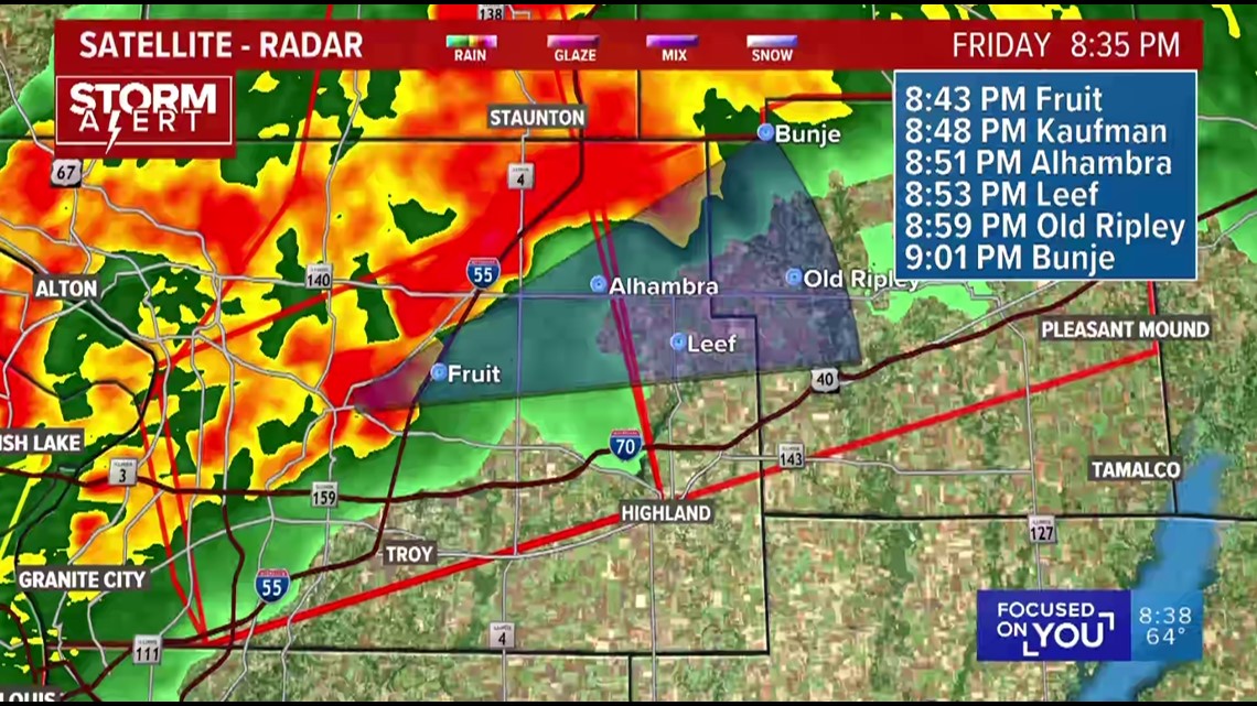
8:36 p.m.
Radar showed debris indicating a large and dangerous tornado over Edwardsville, Illinois.
Fallen power lines should be treated as live wires. Do not approach them.

8:33 p.m.
Meteorologists were watching the Edwardsville area with debris indicated by radar. SIUE was included in the warning area.
Another severe thunderstorm warning was issued for the Rolla area as another line of storms approached the area.
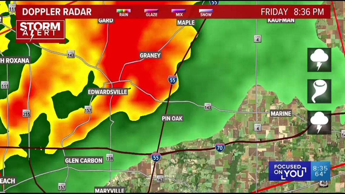
8:30 p.m.
Tornado warnings were active as of 8:30 p.m. with threats of flying debris:
Madison County, Illinois
Macoupin County, Illinois
Jersey County, Illinois
Northeastern St. Louis County
Northeastern St. Charles County
8:27 p.m.
People reported sheltering in place from the storm in various businesses. Karl Lund shared a photo of people taking shelter at Cracker Barrel on Highway K ant 64. Share your breaking news photos, video and news tips at newstips@ksdk.com or text 314-425-5355.
8:20 p.m.


8:17 p.m.
Tornado warnings were active as of 8:17 p.m. with threats of flying debris:
St. Louis City
St. Louis County
St. Charles County, Missouri
Madison County, Illinois
Macoupin County, Illinois
8:14 p.m.
19,000 Ameren Missouri customers are without power.
8:07 p.m.
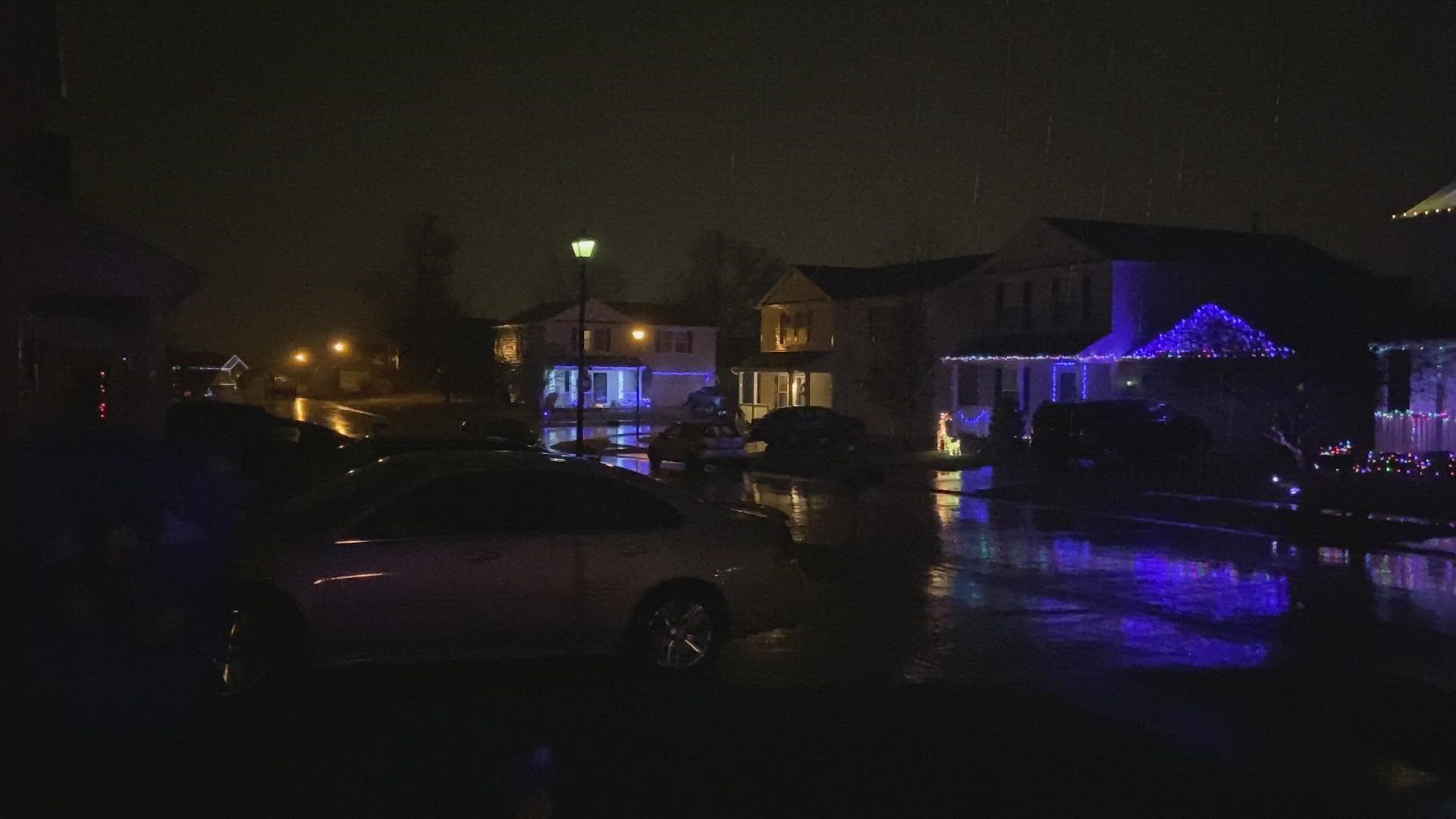
Multiple homes were reported damaged near Defiance.
8:05 p.m.
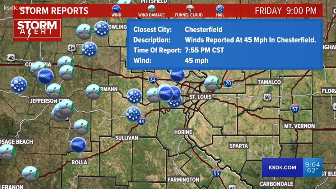
Winds clocked at nearly 70 mph in the Chesterfield valley.
7:58 p.m.
Tornado warnings were active as of 7:58 p.m. with threats of flying debris:
Calhoun County, Illinois
Greene County, Illinois
Jersey County, Illinois
Lincoln County, Missouri
Pike County, Illinois
St. Charles County
St. Louis County
Jefferson County, Missouri
Franklin County, Missouri
Warren County, Missouri
Morgan County, Illinois
Cass County, Illinois
7:55 p.m.


7:54 p.m.
Tornado sirens were going off for the City of St. Louis and St. Louis County. If you hear a siren, take shelter in a basement or low room with no windows.
7:53 p.m.
Performing Arts Center at Troy High School is open for shelter in Lincoln County
7:49 p.m.
Tornado warnings were active as of 7:49 p.m. with threats of flying debris:
Calhoun County, Illinois
Greene County, Illinois
Jersey County, Illinois
Lincoln County, Missouri
Pike County, Illinois
St. Charles County
St. Louis County
Jefferson County, Missouri
Franklin County, Missouri
Warren County, Missouri
Morgan County, Illinois
Cass County, Illinois
7:42 p.m.
Radar indicates there is a tornado on the ground moving along Highway 94 toward Weldon Spring
Go to the lowest interior room of your home. If you do not have a basement, an interior bathroom or closet is good. There should be no windows or outside walls or doors. But a basement is the best location.
Use a large pillow or cushion to shield yourself from debris. A centrally located bathroom with no windows or outside walls works well. Use a cell phone and another NOAA weather radio.
Your severe weather safety kit should already be in your safe place. The kit should include a helmet to shield your head, gloves in case you have to dig out, an extra pair of shoes so you don't step on glass or nails, and a flashlight with extra batteries.
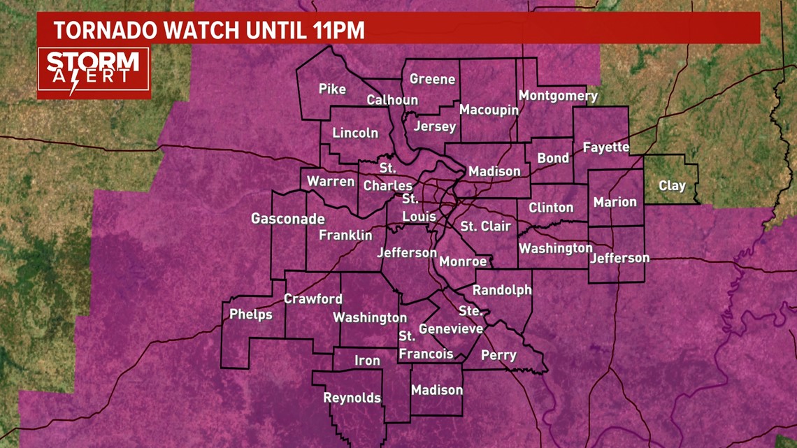
A tornado watch is in effect for all of the 5 On Your Side viewing area and covers a large portion of southern Missouri and central and southern Illinois. The tornado watch includes the entire St. Louis metro area until 11 p.m.

While not everyone will see rain and thunderstorms Friday evening, the ingredients for strong to severe storms are in place. This is the time to be prepared and not scared. Know your safe place and be ready to move to it if severe weather threatens your area.
Isolated tornadoes are possible and the environment is favorable for a few strong to violent tornadoes somewhere along the Mississippi River Valley from our area south into Mississippi and Louisiana. Wind gusts with some storm cells could peak up to 75 mph and few could generate large hail.
RELATED: Check our live interactive radar
Download the free 5 On Your Side app to get the latest watches and warnings and track conditions live with our interactive radar. Use the links below to download now.
5 On Your Side news app
iPhone | Google Play


Simulated radar images from the higher resolution weather models indicate storms will develop during the evening (after 6 pm) into the overnight hours. Many of the ingredients needed for severe thunderstorms appear to be available including a tremendous amount of wind aloft. The severe weather threat should exit the area around 2 a.m. Saturday morning.
In the colder air behind the storm, a swath of wintry weather is expected from western Nebraska to Wisconsin over the next couple of days. Travel may be hazardous with snow and blowing snow in the heavier snow bands in those areas.
The moisture will be gone by the time the cold air arrives in St. Louis, so no wintry precipitation is expected locally.


It will be cooler on Saturday with a brisk breeze in the morning. Expect plenty of sunshine during the afternoon and winds that begin to diminish by sunset.