
ST. LOUIS — It's not unusual to have bad weather in the Midwest. We do, after all, live in tornado alley, but Monday night's storms were not associated with tornadoes. Instead, it was something known as a derecho.
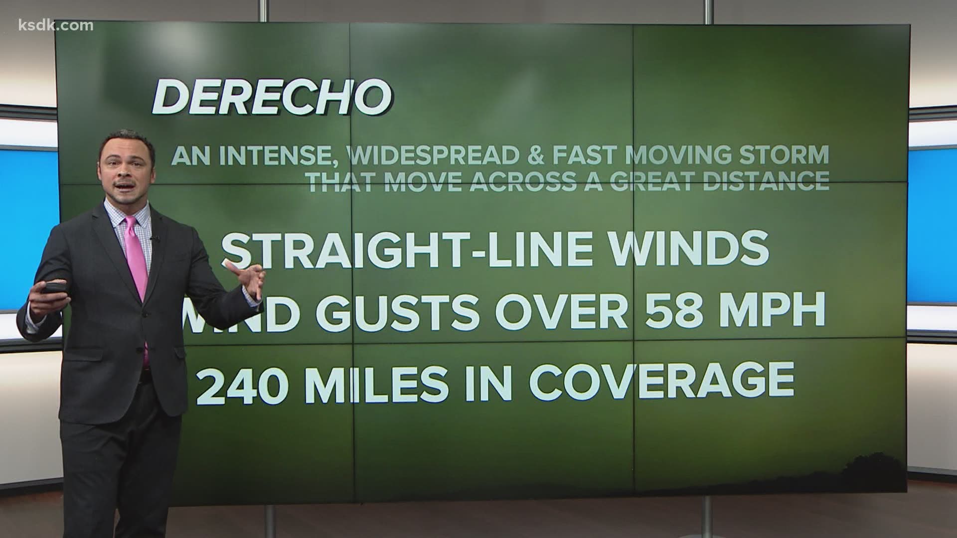
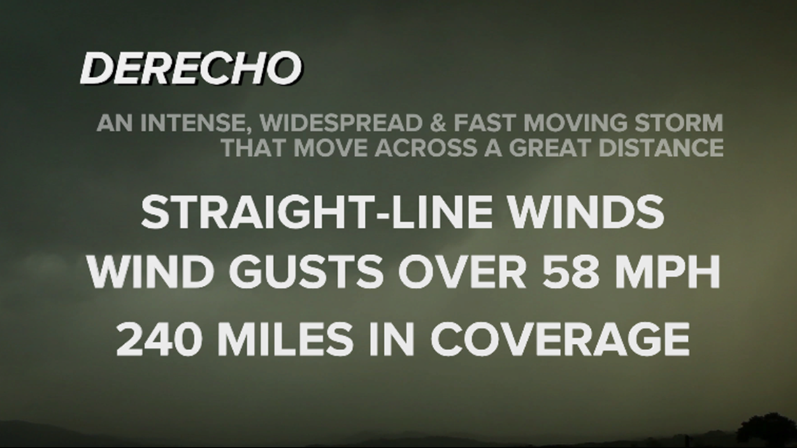
So, what is a derecho?
Its origin is Spanish for the word "right" or "straight" and it's those straight-line winds that make this different from a tornado.
In a tornado, debris is scattered with trees, homes and other objects spewed all over in many different directions.
RELATED: Latest St. Louis area forecast
In a derecho, winds are uniform, meaning most of the winds are blown in one direction. You will often experience wind gusts up to 58 mph with isolated pockets as high as 75 to 100 mph in these wind storms. Derechos usually carve a large path of destruction as well.
By definition, a derecho's wind damage must be over 240 miles in coverage.

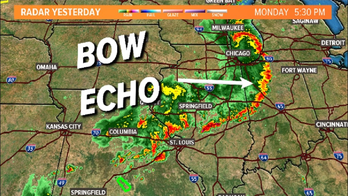
The storms that hit St. Louis Monday originated in Iowa and traveled all the way up to Ohio, causing significant damage there. That's more than 500 miles of wind damage! In fact, there were more than 700 reports of wind damage across the Midwest Monday afternoon, according to the Storm Prediction Center.
The storm originated in Iowa and pushed east and southeast through the day gaining strength as it moved into unstable, moist air. It's the rain-cooled air behind the storms that cause these types of storms to bow outward on the Doppler radar as they encounter warm air.

As those two air masses clash, depending on the strength of the upper level winds, derechos can form. Statistically, the Bi-state has one or two derechos on average per year.