ST. LOUIS — Low pressure still has to make it through the area tonight on into Friday. Many areas have had 1-2 inches of rain, and some areas have seen closer to 3 inches.
Several rounds of showers and some rumbles of thunder will be moving into the entire area overnight through early Friday.
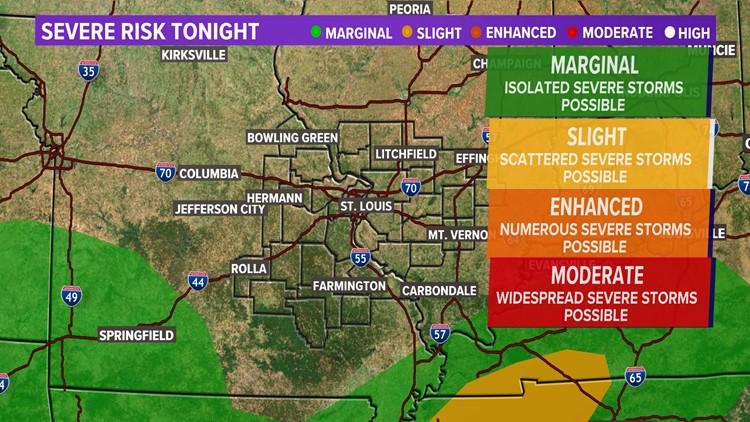
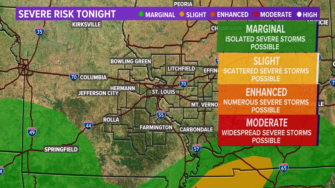
We are missing the ingredients for severe weather.
Download the free 5 On Your Side app to get the latest watches and warnings and track conditions live with our interactive radar. Use the links below to download now.
5 On Your Side news app
iPhone | Google Play

Saturday, temperatures will likely stay below normal with lots of sunshine, highs will be in the upper 60s and low 70s.
High pressure begins to build on Sunday, Mother's Day. High temperatures will be above average, closer to 80. The average high temperature this time of year is in the low to mid-70s. Dry weather is expected, although we can't rule out an isolated shower or thunderstorm later in the day Sunday, especially north of I-70.

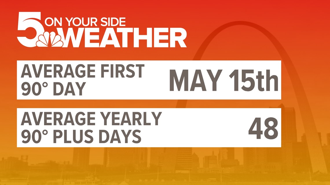
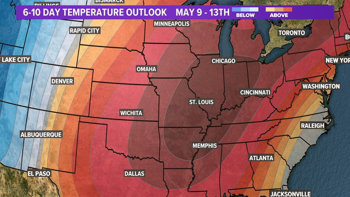
As soon as Monday, we will likely hit 90 degrees for the high temperature under a mostly sunny sky. That's about a week earlier than we normally see a 90-degree day.
Looks like we stay near 90 or in the low 90s for afternoon highs most of the week. It will also be mainly dry.