
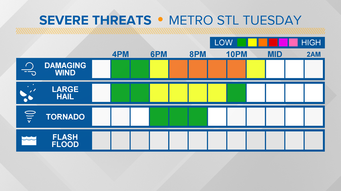
ST. LOUIS — The National Weather Service issued a severe thunderstorm watch for much of the St. Louis metro area that lasts until 11 p.m.
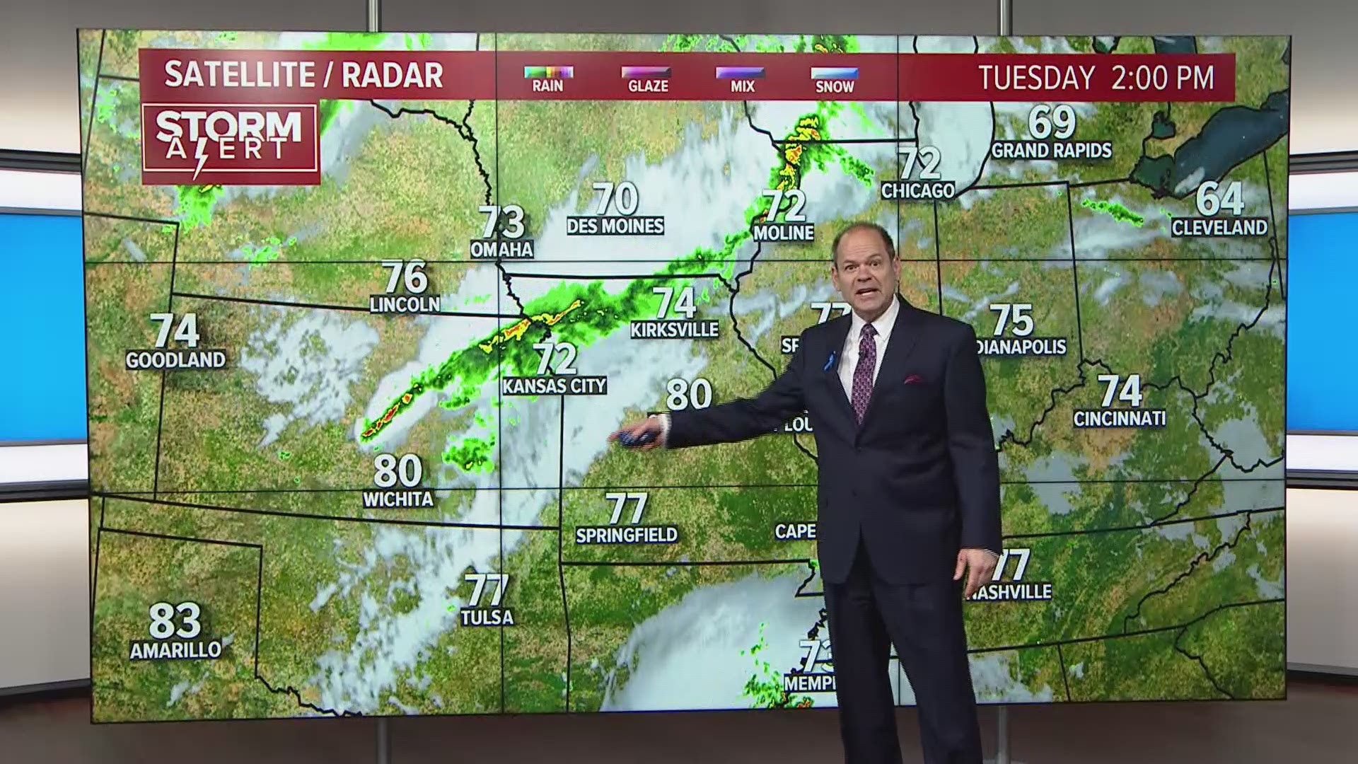
Temperatures have climbed into the upper 70s and lower 80s across the region this afternoon. We are still tracking a strong cold front that will sweep across Missouri and Illinois tonight. Thunderstorms will blossom ahead of the front heading into the evening with a few renegade showers or storms possible ahead of the main line.
The storms are expected to become organized into a line as it moves from northwest to southeast across the area. The ingredients appear to be coming together for at least a few of the storms to produce gusty winds and some hail and maybe a brief, isolated tornado or two.
Download the free 5 On Your Side app to get the latest watches and warnings and track conditions live with our interactive radar. Use the links below to download now.
5 On Your Side news app
iPhone | Google Play
LATEST HIGH RESOLUTION FUTURECAST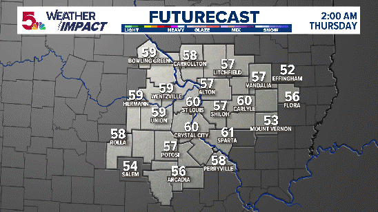
The main threat will be during the evening from about 6 p.m. until 10 p.m. across the metro St. Louis area. The main threats will be damaging winds in excess of 60 mph and perhaps some hail. While an isolated tornado cannot be ruled out, the best chances seem to be farther to the north across northeast Missouri and west central Illinois.

Colder air will filter in behind the system providing a chilly, breezy and damp Wednesday. The week will end with a warming trend as temperatures climb into the 80s Saturday afternoon.
More weather stories
- Why morning sun is key to a good night's sleep
- How to watch the digital Weather Academy from the 5 On Your Side weather team
- Cool clouds sweep over St. Louis area ahead of storms
- Where to find Morel Mushrooms in the St. Louis area
- As people stay home, Earth turns wilder and cleaner
- How the 'Waffle House Index' can show the impact of coronavirus