
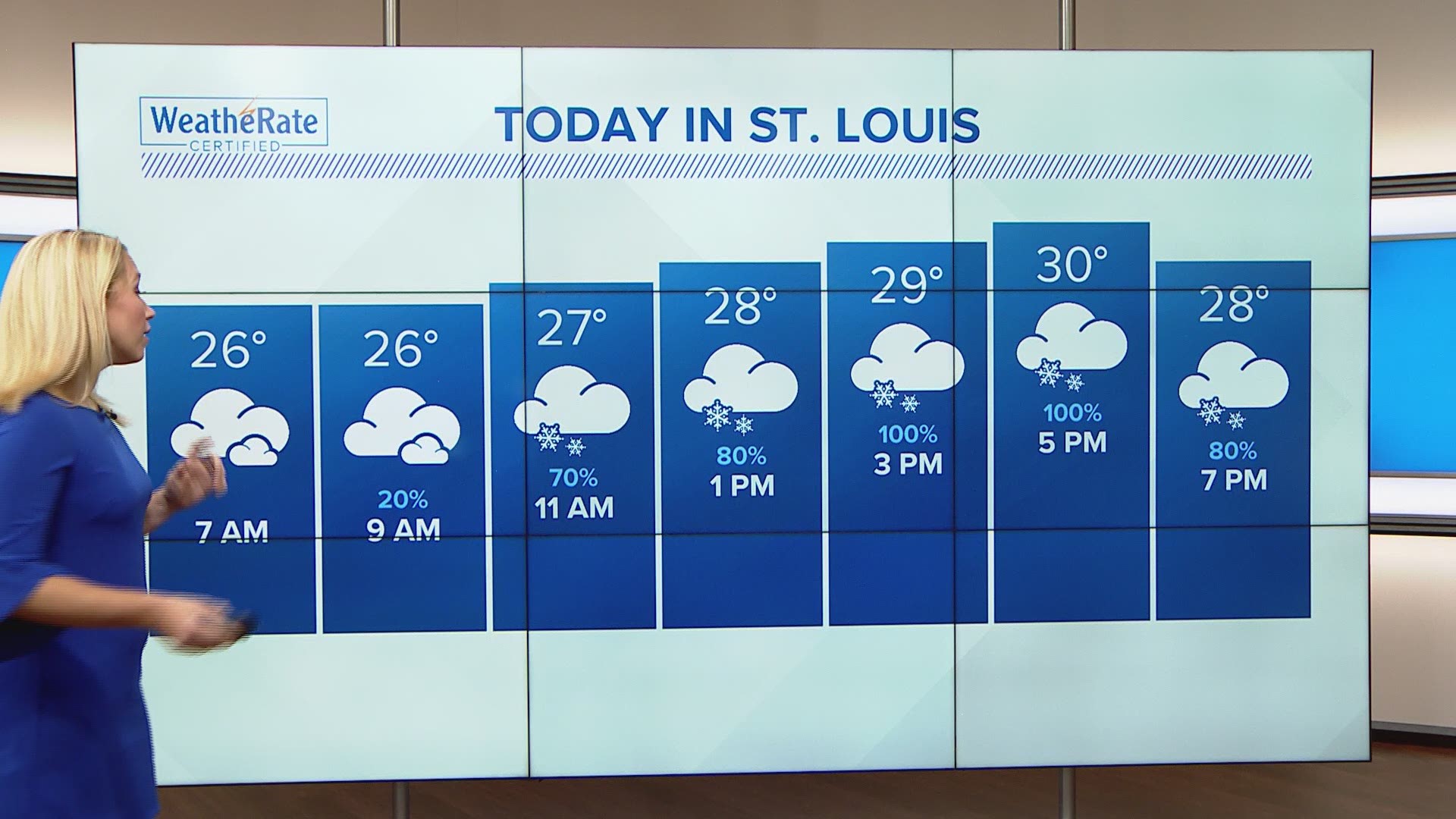
ST. LOUIS — Bands of snow continue to move through the area this afternoon into Sunday evening. A quick one to two inches of snow with each band is possible. Farther south, the snow will change to freezing rain with up to two tenths of an inch of glaze possible.
A Winter Storm Warning in in effect for much of the area. Snow totals will range from nothing far south where it is too warm for snow to around five inches by Sunday night north and northwest of St. Louis. Additional accumulation is expected later Monday and Monday night before this system finally moves away.

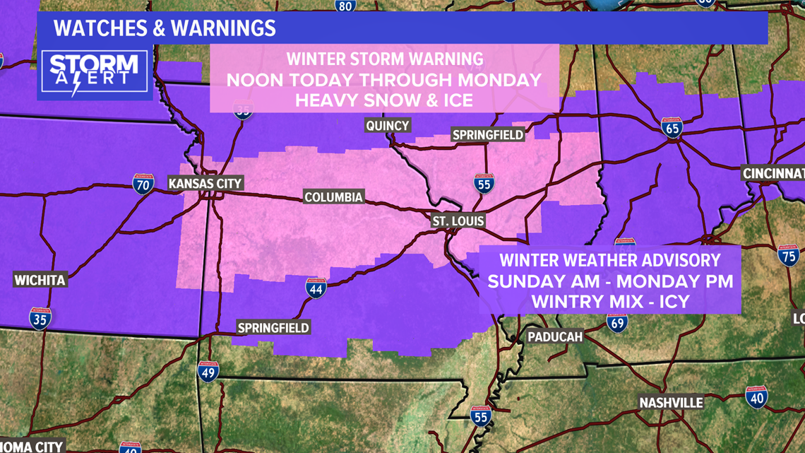
Ice will be an issue with this system. Watch the video below and follow the freezing rain, sleet line (pink) as it pushes northward Sunday afternoon.
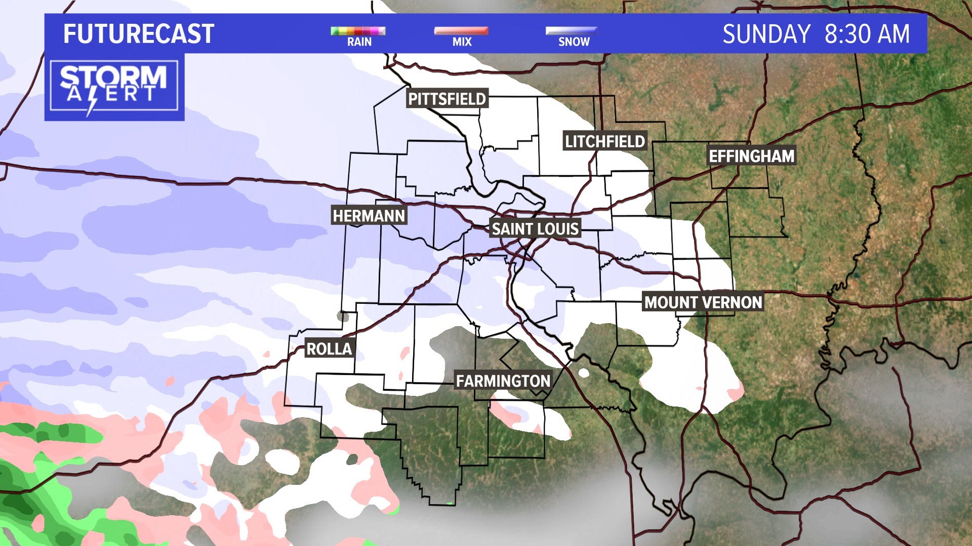
Some areas far south will luck out with just cold rain. The majority of us though will be in the snow and ice into Monday.
RELATED: Live interactive radar
Storm total snow accumulations may be more than six inches north of St. Louis. Totals in the metro will largely depend on how much freezing rain falls. Southern parts of the metro may only see one to three inches. Even father south, accumulating snow will be hard to come by as freezing rain or just a cold rain are expected.

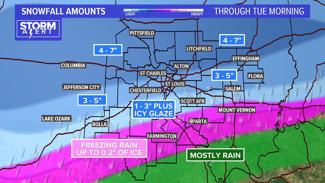
After the first round winds down later Sunday evening, freezing drizzle will likely linger through the overnight hours into Monday morning. Later Monday, the second wave of this system will bring us another round of mixed precipitation that changes to and ends as snow. The highest snow totals are expected to be where both Sunday and Monday's heavier bands of snow fall over the same area.
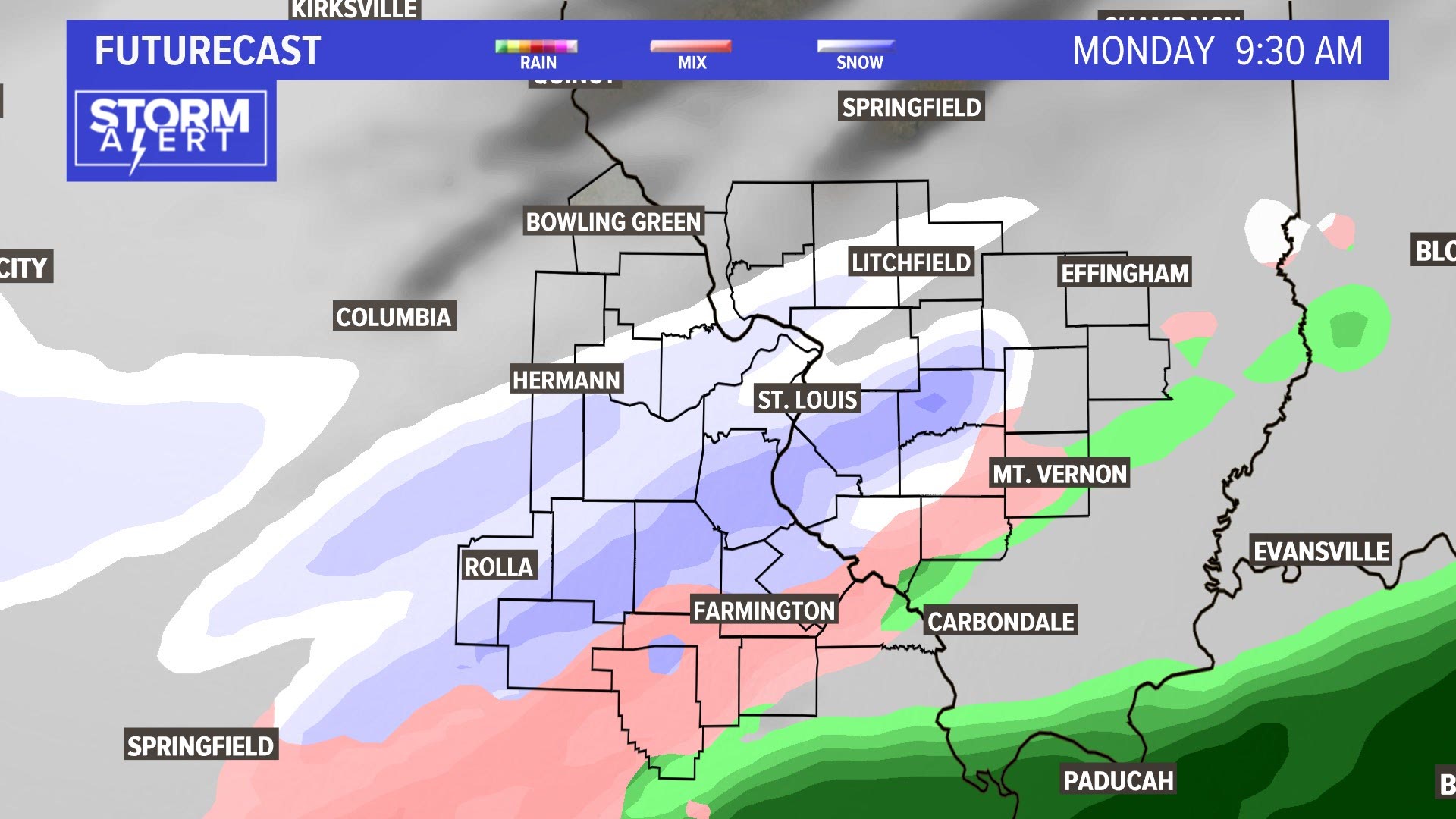
The last hurrah for this winter storm will hit in the evening Monday and wrap up by Tuesday morning. With more people on the roads and back to work on Tuesday, the roads could actually be worse than Monday. Morning temperatures Tuesday will be in the teens and twenties so slick icy conditions are guaranteed.
Download the free 5 On Your Side app to get the latest watches and warnings and track conditions live with our interactive radar. Use the links below to download now.
5 On Your Side news app
iPhone | Google Play