


ST. LOUIS — The buds on the trees around the greater St. Louis area are already popping given the sixth warmest February on record. The recent cold weather during the middle of March has tempered the spring blossoms a bit.
The cold pattern is changing and the number of days below freezing heading into April should be limited. However, we typically expect frost or freezing conditions at least a few times into the middle of April.
The trend of infrequent and limited blasts of arctic air this winter will lead to lower chances of snow into early April. Not that it can’t snow or won’t a little, but the chances it’s cold enough for a significant snow are definitely on the way down as we begin to see the mid-March chilly pattern adjust.
So far, snowfall from last November through the first day of spring is well below average. Snowfall at St. Louis Lambert International Airport, the official reporting station for St. Louis, was measured at 5.4 inches. If there is no additional measurable snow, this will likely be the fifth least snowiest season on record.
As always, a big focus will be on the Mississippi and Missouri Rivers. Minor river flooding along the big rivers is common in the spring. This year, the snowpack to our north in the Mississippi River basin and the Missouri River basin is above average.

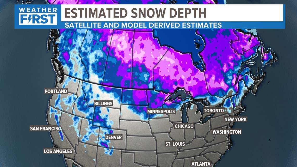
While the melting snow will contribute to the flooding potential, significant flooding will only occur if heavy rain occurs upstream as it could combine with the melting snow to produce flooding. The river levels have been lower than seasonal averages through the winter, especially the Missouri River. The chances of at least moderate flooding are higher on the Mississippi River and near average on the Missouri.
Looking into the Pacific waters, after three winters of La Nina, the waters in the Equatorial Pacific are warming.

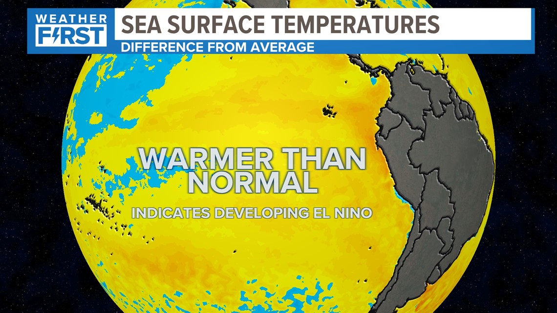
La Nina is over and neutral conditions are expected through May. After that, an El Nino pattern is expected to develop over the summer into the fall.

El Nino patterns during the summer have limited impacts on temperatures and rainfall across the Midwest.

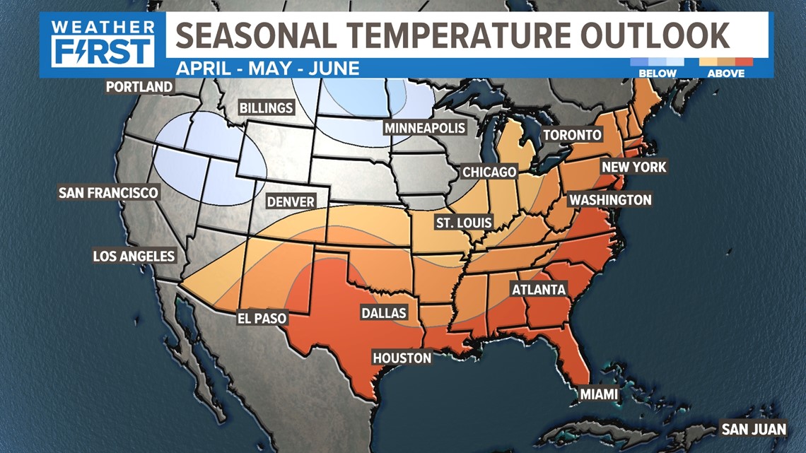
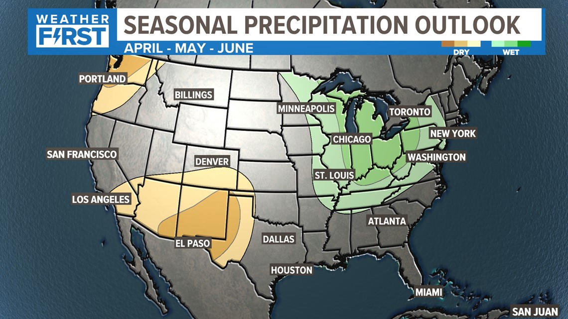
We do anticipate rainfall being above average in April, near average in May. Temperatures will likely be a bit above average.

Severe thunderstorms can happen anytime in St. Louis, but the most likely time for severe weather is March through May.
Nothing really stands out this year to indicate it would be a particularly active severe weather season.


With the potential of temperatures being above average later in April and May, given the right ingredients, there will be severe threats.
Historically, May is our biggest severe weather month for hail and tornadoes.
Download the free 5 On Your Side app to get the latest watches and warnings and track conditions live with our interactive radar. Use the links below to download now.
