

ST. LOUIS — Thursday brought a drastic and a dangerous weather change.
The anticipated arctic blast arrived Thursday morning and dropped our temperatures from the middle 30s early in the day to single digits by the afternoon. Snow has spread into the St. Louis area, but has come to an end and now roads are snow packed and snow covered. Officially, at St. Louis Lambert 1.8 inches of snow fell.
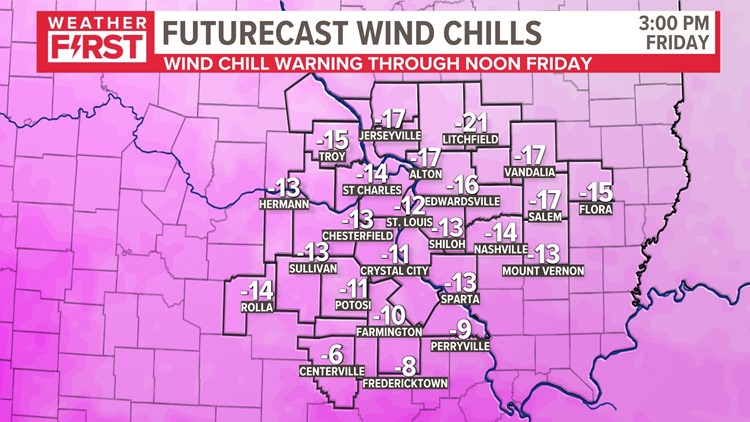
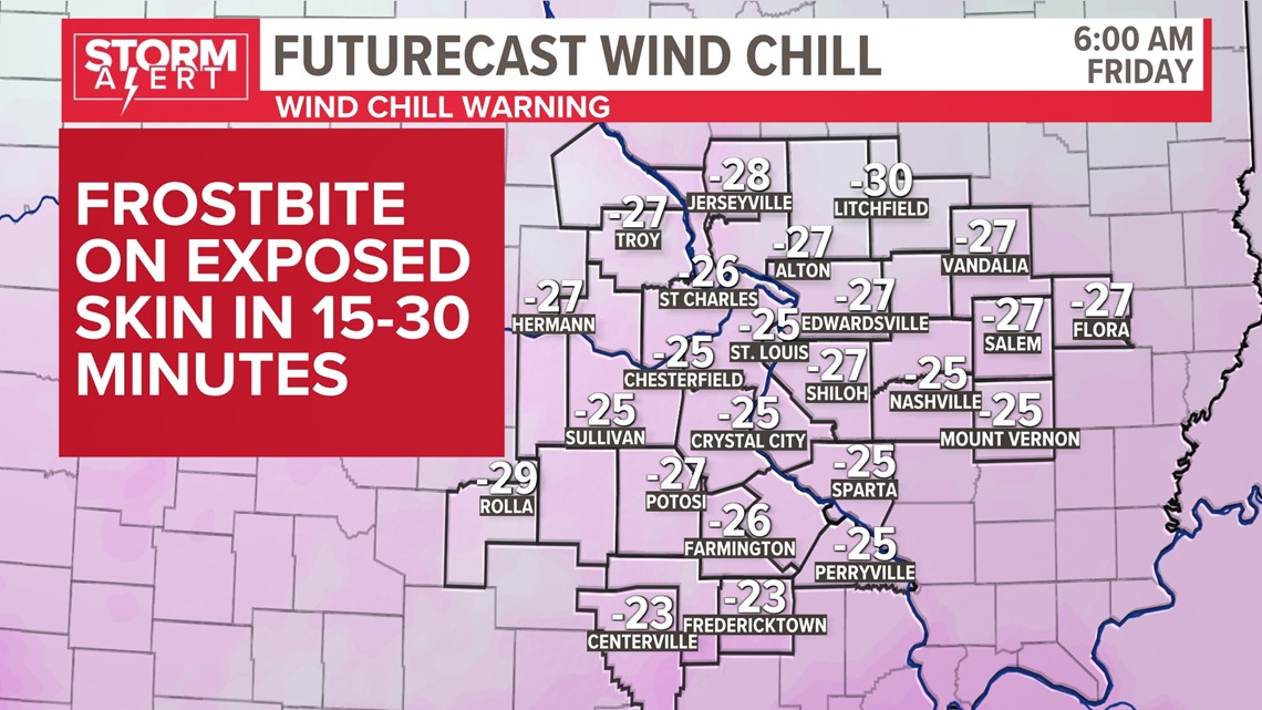
Wind chills will remain -35 to -25 during Friday morning with wind chills -20 to -10 by Friday afternoon. Wind chill warnings will remain in place through noon on Friday with wind chill advsiories in place through Saturday.
Download the free 5 On Your Side app to get the latest watches and warnings and track conditions live with our interactive radar. Use the links below to download now.
5 On Your Side news app
iPhone | Google Play
Peak wind gusts are expected to be in the 35-45 mph range through the day on Friday with winds relaxing some on Saturday. Temperatures will climb into the teens on Saturday and 20s on Sunday with dry weather expected until Sunday night.

Sunday night, another weak system could move overhead bringing a slim chance of light snow Sunday night into Monday.
