ST. LOUIS — After a comfortable start to August, our typical heat and humidity has returned along with the chance of thunderstorms.
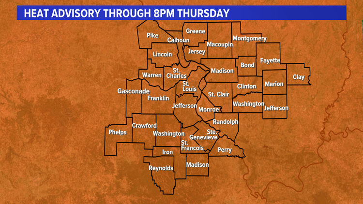
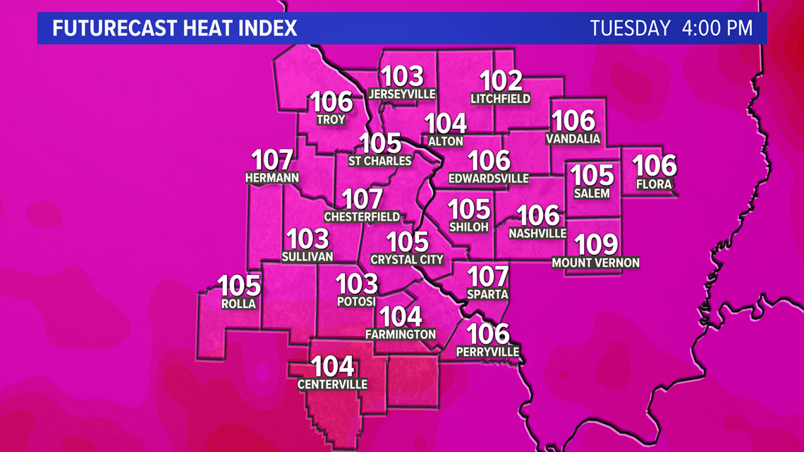
A heat advisory is in effect through Thursday evening across the bi-state region. High temperatures each day will top out in the mid to upper 90s with heat index values pushing over 100 and in some cases over 110°. The only brief relief would come in the form of a few thunderstorms.
Download the free 5 On Your Side app to get the latest watches and warnings and track conditions live with our interactive radar. Use the links below to download now.
5 On Your Side news app
iPhone | Google Play
RELATED: Live interactive radar

There is a chance of scattered showers and thunderstorms, especially in the early morning hours and again late in the afternoon and evening. Any afternoon or evening storm will provide some temporary relief from the heat but keep the humidity levels high.

There is a chance of severe storms Tuesday afternoon and evening across a good portion of the region. The main severe threat would be damaging wind gusts.
Remember, high heat coupled with high humidity increases the risk for heat-related illness.
So, limit your time outdoors during the hottest time of day, wear loose, light colored clothing and try to get into the air conditioning as often as possible. Drink plenty of water. Keep pets inside during heat like this and remember to check on elderly family and friends along with your children.
The first sign of many heat-related illnesses starts with the sweat glands. If you're outside this week and not sweating, that could be your first sign that you may be getting overheated and/or dehydrated.